Saturday, July 25, 2020

Ledges, Lichens, and a Loop - Southern Maine Nature Trail

    In the late hours when other people are scrolling social media, reading a book, or binging Netflix, I am lying in bed internet-searching for new trails for myself and my kids.  Although I hike all year round - summer is truly my biggest "hiking season".  I have summers "off" and like to fill my days with my young children hitting the trails.  Here on the Seacoast, we have amazing kid-friendly, but I'm always looking for more.  And this week, I found one!  
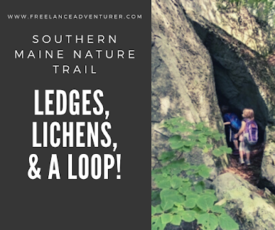
    Nestled in a small preserve on the South Berwick/Ogunquit town lines is a perfect little-kid loop trail that provides views of ledges and even caves - all covered with beautiful lichens and mosses.  What's more, it's a loop!

Southern Maine Nature Trail with a cave


Here's how to recreate this adventure...

Adventure: Kenyon Hills Preserve Loop Trail in South Berwick, Maine

Getting there:  For GPS purposes, the official address location is 110 Ogunquit Rd, South Berwick, Maine.  To get there from Dover, NH take Route 4 (Portland Ave) towards South Berwick, Maine.  Continue on Route 4 until it splits in South Berwick.  Curve right to get on Agamenticus Rd and drive for a quarter mile.  Turn Right on Emerys Bridge Rd and continue for 1.6 miles.  Turn right at Bennettlot Rd and continue for 4 miles.  Finally, turn right onto Ogunquit Rd.  The trailhead is on the right about 2 miles up.  The trailhead is well signed saying "Kenyon Hill Preserve: Great Works Regional Land Trust" from the road and their is a small uneven (free) parking lot.  The trail is open dawn to dusk.
kenyon hill preserve sign in South Berwick Maine
Trail sign from the road: Kenyon Hill Preserve / Great Works Regional Land Trust

Trail:
  From the parking lot, walk back from the road.  There is a small laminated signed stapled to a post showing the loop (see photo).  I also used AllTrails to record my hike so I wouldn't get lost. The trail is a well blazed one mile loop with blue blazes, however there are small small offshoot trails.  
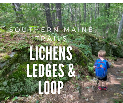
    From the initial fork, we decided to start right - doing a counter clockwise trek.  This was a great choice because a lot of the "attractions" are early on this portion of the trail.  We saw huge glacial erratic boulders covered in lichen and moss, towering rock faces, and smaller rock piles perfect for toddler/preschoolers to climb. 
    The trail is easy but has some roots and rock tripping hazards (my four year old fell a few times).  There are small changes in elevation gain but nothing too noticeable. About half way through the loop we went up an incline and according to the AllTrails topo map, we were at the tallest point in elevation on the trail.  We scrambled up a large rock and enjoyed our lunch.   
    The last half mile of the trail was easy, flat, and straight.  Even though this trail is only one mile, our scrambling and exploring of small off-shoots clocked our hike at 1.8 miles, and we spent 90 minutes here!  The climbing rocks and cave made it a really fun one for kids, but adults will enjoy the varied views and beautiful lichen/moss covered rocks as well.
Curly lichens grown on large rock faces throughout the trail

Difficulty: The short distance and fairly easy terrain makes me categorize this trail as over all EASY but Great Works Regional Land Trust that manages it, labeled it "moderate".

Distance: 1 mile loop. However, we must have done a lot of off-trail rock exploring because I clocked our trek at 1.8 miles total.  

Recommendations:

- Parking is limited but it was not busy.  We only saw one other hiker on a sunny, summer weekday morning. There are no bathrooms or trash receptacles at the trailhead.

- The trail was clean.  Please keep it this way by carrying out your trash.

- Keep track of the blue blazes.  There are other "non-official" trails that are not blazed.  We accidentally meandered down a couple.  

- Bring bug spray.  The bugs weren't horrible but there were a few wetland type areas along the trail where the mosquitoes were noticeable.  

- Dogs are allowed on the trail.


This trail reminded me of one of our other favorite loops - the Winnie-the-Pooh Trail - that also has rock ledges and caves.  The kids really liked it and so did I.  I'm so glad my late night internet searches paid off!

Southern maine trail for kids


You might enjoy these similar adventures...


Beautiful kid friendly hike in southern maine


Wednesday, July 22, 2020

5 Miles, 3 Peaks, 1 Loop: Day Hike in New Hampshire's Lakes Region

New Hampshire Lake region hike

My summer quest to seek out new and beautiful hikes continues!  I "found" this hike by following another New Hampshire hiker on Instagram.  She showed photos of a loop hike that incorporated three mountain peaks - all with fantastic views of New Hampshire's iconic Lakes Region.  This is hike was an attractive choice for me for three reasons:

1. It's close(r) than the Whites (only an hour from the Seacoast)
2. It has amazing views of mountains and lakes from the peaks
3. It's a loop!!!

I found friends to tackle it with me on a hot and humid late June day.   I loved it so much...I did it again the next week!!

Here's how to recreate this adventure...

Adventure: Piper, Belknap, and Gunstock Loop

Getting there: The trailhead is located on Carriage Road in Gilford, New Hampshire.  To get there from the Seacoast, I drove west on Route 11 (Mt Major Hwy) from Alton toward Gilford.  From here, take a left onto 11A (Cherry Valley Road).  Drive about 8 miles and take a left onto Belknap Mountain Road.  After 1.3 miles, turn left onto Carriage Road.  After 0.4 miles the lower parking lot is on the left.  It has room for about 4 cars.  Parking is not permitted along the road.  When we got there the lot was full (weekday morning) but there is an overflow lot about a quarter mile (guessing) up the road on the right that can hold an additional 5 cars or so.  This is where we parked then walked down the road to the trailhead.
Standing on Piper Mountain
Standing on Summit of Piper Mountain
Trail:  The trail system is complex but well signed.  I recommend using a map or recording your trip through AllTrails.  We frequently double checked were on the right trail system.  I decided to take the trail clockwise- starting with Gunstock, then Belknap, then Piper.  
    The trail entrance to Gunstock Mountain is just at the lower parking lot.  It was actually kind of hard to find but it's just up hill from the large trailhead sign.  
    Once on the trail it was a pretty steady up to the Gunstock summit.  Before you reach the actual peak there's a nice viewpoint (with a picnic table) that overlooks the lakes.  At the summit you are reminded that this is a ski hill!  We saw another hiking group eating a snack in the shade of the chair lift.  There are fabulous views of Lake Winnipesaukee. 
    From Gunstock, go back into the woods and follow signs to Belknap.  The trail dips down gradually and then climbs again to get to Belknap Mountain - peaked with a climbable fire tower for the view!
To get to Piper Mountain, take the White Trail to the Old Piper Trail to Piper Mountain Summit.  This is a fairly bare summit and my favorite of the three.  I enjoyed wandering around to see views from all sides. 
Continue on the Old Piper Trail down to the parking lot.  
  
Difficulty: Moderate - The up and down make this a workout.  All Trails claims there is 1,827 ft of elevation gain in total which is nothing to squawk at!  Still, there is no technical skill needed for the climb (no slab or scrambling) - just good old fashioned up and down.  

sign on gunstock mountain trail

Distance: 5.5 mile loop

Recommendations: 

- I've done this hike twice in the last month.  The first time, I arrived on a sunny weekday around 10 am and the lower lot was full (4-5 cars).  There were still plenty of spaces in the upper lot (4-5 cars).  The street is covered with "No Parking" signs for over a mile, so if you want to guarantee a spot, get there early and avoid weekends.  The second time I went it was a cloudy/rainy day and there was no competition for spots.

- Use AllTrails to help guide your way.  There are a lot of side trails running in and out of Gunstock and Piper and a hiker could easily take the wrong trail.  All the trails are well marked, but unless you have a clear idea of which to take, I'd recommend the assistance of a map or technology.

- There are no bathroom facilities at the trailhead.

- This is a dog friendly trail.

My friends and I really enjoyed this loop.  If felt like we got so much bang for our buck!  I ended up going back the next week and did just the Piper peak in the rain with another friend.  What a difference the rain made - gorgeous bright green moss and trickling streams really gave the trail a romantic vibe.  This hike is one of my new favorites!
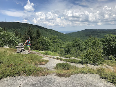
Views in Belknap Mountain Range

You might also enjoy these adventures...