Monday, November 17, 2014

Knife Edge Crossing

Kelly crosses the Knife Edge Trail on Mt. Katahdin, ME
Last year, I hiked Mt. Katahdin in Maine over Columbus Day weekend.  For my first ascent, my friend Sarah and I took the steep Abol trail up and the long Hunt Trail (AT) down.  This year, I decided to tackle it again - this time taking a stab at the infamous Knife Edge Trail to the summit.  This narrow and exposed ridge line has a reputation for one of the most challenging hikes in the Northeast, and was on my bucket list as a "must- try". My sister, Kelly, agreed to conquer the mountain with me.  It was an amazing adventure.


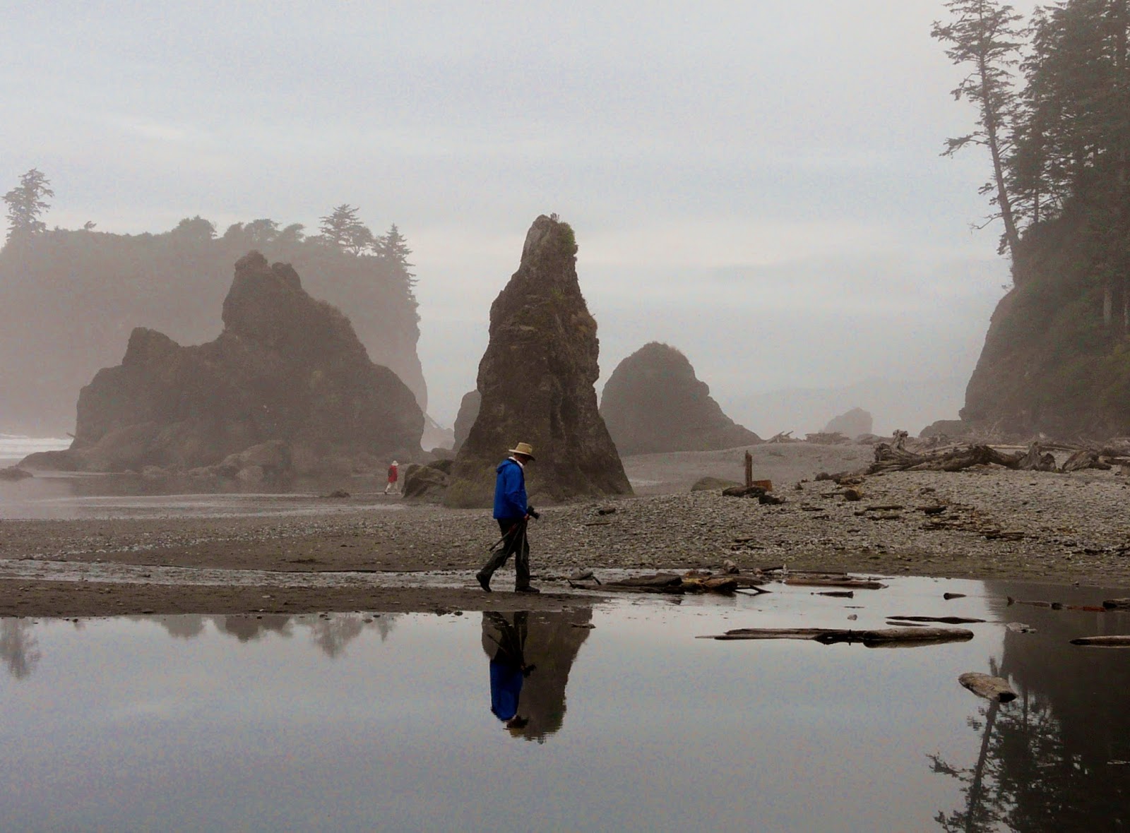
Here is a peek at our adventure...

Driving into Baxter State Park
Abol Campground, Baxter State Park
Permits - Baxter State Park requires visitors to have a permit to enter, stay, and camp in the park. Maine residents get dibs on early reservations.  Read your reservation carefully.  Day reservations must be claimed by 7 am on the day or they are given away.  Camping reservations ensure your spot for the day as well as a parking spot.
 Reservations can (and should) be made ahead of time.  Even trying one month ahead, we did not get our first choices on campgrounds.  Try MULTIPLE months prior to ensure you get your site.  Rules and cost about reservations can be found HERE or by calling park headquarters at (207) 723-5140.


Lil' Abol Falls near Abol Campground
Camping - We arrived at Baxter State Park on Saturday mid-day.  It was about a 5 hour drive from southern New Hampshire.  I had made reservations to spend our first night at Abol Campground.  We arrived at Abol, set up camp, and took a few small hikes around the park - Lil' Abol Falls and Elbow Pond.  These were pleasant short hikes with awesome views.  The second night, we spent at Roaring Brook Campground.  This is where we hiked to-and-from our Katahdin climb.

Both Abol and Roaring Brook Campgrounds had roomy, nature sites with fire pits.  There is no running water available.  Campers can treat river water or drive in their own. Firewood can be purchased from the camp ranger.  Outhouse/Privy toilets are available as well.  We stayed in a tent site at Abol and a lean-to site at Roaring Brook.  Both were spacious and comfortable.  I highly recommend the campgrounds.


On the Summit of Mt. Katahdin

Route - The goal of our trip was to tackle Mt. Katahdin from the Knife Edge trail.  This notorious trail is a highly exposed 1 mile stretch of ridge between Pamola Peak and Baxter Peak (highest point on the mountain).  This ascent should only be attempted under fair and dry weather conditions.  During October, while it felt like fall at the base, it was winter above, so adequate cold-weather gear was an additional necessity besides water, food, map, compass and first aid.

Kelly and I got up at 5 am, packed up at Abol campground and drove to the other side of the mountain.  We arrived at Roaring Brook Campground, in the dark, at 6 am.  After securing our packs, and signing into the ranger station, we were on the trail by 6:30 am - just as a sun was rising.

Cold summit of Mt. Katahdin
We took the Helon Taylor Trail up.  The trail was rocky and moderate as it ascended through the woods.  At 2 miles we passed the treeline and were rewarded with amazing views of the fall foliage below.  Rocky slab made for a tiring but still-moderate climb.  At 3.3 miles we summited Pamola Peak (4,902 ft).  This peak gives views of the Knife's Edge all the way to Baxter Peak.

The Knife Edge begins by steeply descending onto the base of the "Chimney" - a rocky point along the relatively smooth ridge-line.  From here, the climb just gets harder.  And it is...A CLIMB!  All extremities were needed to then climb up and then back down the steep outcrop.  In addition to the technical climbing (no ropes or anchors available), the exposure makes the experience that much more harrowing.  I'll be honest - I was terrified during the chimney portion on the climb.  After the first half mile, the trail becomes less steep but still very exposed.  Although scary, this trail awards its climbers with the most amazing views on the mountain and peaks.  From Pamola Peak, the Knife Edge is 1.1 miles to Baxter Peak - the summit of Mt. Katahdin (5,269 ft).

Looking over the Knife's Edge, Mt. Katahdin
It was a relief to reach the summit. The peak was crowded with hikers.  We took a photo at the iconic Mt. Katahdin sign and ate a quick lunch.  The cold weather, crisp wind, and sweaty clothes made us both cold, and it was uncomfortable sitting for long.  The year prior, I had worn a light sweatshirt and spent over an hour on the summit on the same weekend.  Now, ice and frost covered the rocks and alpine plants.  Its was a harsh place.

From the summit, we continued onto the Saddle Trail.  This 2.2 mile section took us to Chimney Pond junction.  The trail started with a gradual descent across a plateau.  Afterwards, a steep 0.2 mile section took hikers down what essentially is a slide.  Although less-technical than Knife's Edge, this section was still challenging and strenuous.  Watch for falling rocks.  After the slide, the trail became moderate once again, eventually leading us to the Chimney Pond and camp.

"Easy" part of the Saddle Trail
The Chimney Pond trail took us the last 3.3 miles back to Roaring Brook.  This easy- moderate trail
travels through Maine woods wilderness.  We hoped to see a moose, but alas, they stayed in hiding.

We returned to Roaring Brook Campground at 3 pm.  In total, our 9.9 mile hike took us nine hours.  It was great to get back, set up camp, eat some dinner and crash for the evening.

The next morning, sore and happy, we packed up and returned to New Hampshire.  We had achieved our goal.


Katahdin Views
Advice -

- Book your reservations WAY in advance!   We originally wanted to spend the night at Chimney
Lake near entrance of Baxter State Park
Pond Campsite, but a month in advance was not enough to get a spot - even on a cold fall weekend.  

- Know the rules about parking and permits.  Last year, I lost my reservation because I entered the park after 7:30 and my permit had been given away.  Check the website and rules!

- Be prepared for all kinds of weather. Last year I wore a light shirt and summer hiking pants.  This year I was donned in full ski gear.  Bring multiple layers of clothing and remember - Cotton Kills!

- Bring plenty of water or a way to treat water in the park.  The water source is the local streams and rivers and should be treated to prevent water-born illnesses.

- Don't count on Millinocket meeting all your shopping needs.  It is a small town and does not have many amenities.  You can only buy firewood in the campgrounds ($3).  

- Watch the weather.  Knife Edge can result in a deadly climb if attempted at bad weather.  Check in with the Rangers for up-to-date trail conditions before you climb.  

- Explore other parts of the park.  The lakes, waterfalls, and hardwood forest is incredibly pristine and beautiful!

A great hike up Mt. Katahdin
Please leave comments and questions below...

Friday, October 10, 2014

Guest Post: Mt. Pemigewasset Fall Hike

Mt. Pemigewasset Summit Views.  Photo by Bruce Hansen.


Trail Sign for Mt. Pemi
It may be hard to pronounce, but this hike is a must-do for people who love amazing views and are capable of making the moderate 3-mile round-trip trek.

From the summit, hikers are rewarded with vast scenic vistas of the White Mountain National Forest located near the high peaks of the Kinsman and Franconia mountain ranges.

On this hike, expect a varied trail leading under Highway 93, up a pleasant, flat path and ending with steepish bowling-ball to beach-ball sized rocks covered with tangled tree-roots.  Along the trail hikers can also expect some charming creek crossings and forest views.
After a rain, there could be mud in places.
Follow the Blue Blaze

Along with the view on top, hikers will find a genuine New Hampshire granite drop-off with no safety fences.  This is a wild and beautiful place.

Busloads of tourists come for the flume gorge hike, but walk right past the trailhead for this wonderful view-hike.  If you drive to Franconia Notch State Park, you'll have access to free parking and flush toilets as well as trail advice from park rangers.

It's best to park in the highest of the three lots and head towards the bike trail.  Quickly the footpath to Mt. Pemiewasset will be clearly marked with painted ablue blazes along the wooded trail all the way to the top.

Photos of fall colors on Mt. Pemigewasset hike
We saw people hiking with shorts and sneakers, but suggest Nordic walking sticks, ankle-supporting hiking boots and other standard hiking safety equipment, water and snacks.  It seems no one forgets to take a camera on this hike.  Afterwards you can tell your friends that you hiked to the top of Indian Head since only locals can pronounce Mt. Pemigewasset 
  1. Golden Rd, Millinocket, ME 04462
.

Contact info:
Franconia Notch State Park
Flume Gorge
Daniel Webster Hwy
Lincoln, NH 03251
(603) 745-8391


Bruce Hansen
Meet the Expert : Bruce Hansen
Bruce Hansen is a world traveler and writer.  He is a frequent contributer to travel magazines including Rider and Canoe and Kayak.  His experience as a freelance motorcycle journalist has taking him on adventures around the world including long rides through New England.  His book Motorcycle Journeys Through the Pacific Northwest is available from Amazon and White Horse Press in Conway, NH.  


White Mountain Fall colors


Please leave comments and questions below...

Tuesday, October 7, 2014

The Perfect Fall Foliage Hike

Chocorua Lake with Mount Chocorua in background
If you are looking for beautiful fall foliage, lake and mountain views, and a moderate hike, than Mount Chocorua is for you!  This peak has multiple ascents, but after a fresh rain the night before, I chose to adventure up the Champney Falls trail where I could get a view of the falls on the way.

Adventure:  Mount Chocorua via the Champney Brook Trail
Hiking on Mount Chocura

Getting there:  The trailhead is located on the south side of the Kancamangus Highway.  From southern New Hampshire, take Rt. 16 North, and turn left onto 112/Kancamangus Highway.  The trailhead parking lot is located 11 miles down on the left.  There is a small dirt lot.

Trail:  The Champney Falls trail started out with a small river crossing.  We continued up on an easy trail through colorful hardwood forest.  The trees were yellow, red, and orange.  After about 1.5 miles, we reached Champney Falls.  We took a break and explored the area, ate a snack, and rested.

Trail head to Champney Brook Trail
Continuing up, the trail turns into a steep set of stairs.  This leg burner continues for about a half mile and eventually returns to an easy-moderate grade.  At 3.3 miles, we reached the Piper trail/Champney Falls trail junction and continued up to the open rocky peak.  Follow the blazes and cairns over a moderate-difficult slab to reach the summit of Mount Chocura (3500 feet) at 4 miles.  There are amazing view from everywhere on the uninterrupted summit.  We enjoyed lunch on a small ledge that protected us from the wind and gave us a colorful view of the changing leaves below.  After lunch, we continued down the same way we came.  Watch the signs closely or consult your map...you wouldn't want to head down the wrong trail!

Some slab climbing required at the summit of Chocura.
Difficulty: The trail ranges from easy to moderate.  The hardest part is the summit's rocky slab which
has some difficult steps.  Take care...under wet or windy conditions. It could be very dangerous.

Distance:  4 miles one way.  8 miles out-and-back.


Fall leaves along trail

Champney Falls
Recommendations:

- This is a popular hike.  To guarantee a parking spot and avoid the crowds, arrive early.

- If coming from the south, make a stop at Chocura lake - I enjoyed early morning light on the beautiful lake and views of the peak.  Along the Kancamangus Highway, I enjoyed stopping at the Covered Bridge campground and also at Rocky Gorge along the Swift River.

- There are no bathrooms at the trail head.

- You need a White Mountain National Forest parking permit to park at the trail head.  The cost at the trail head is $3 per vehicle per day.  Bring exact change.


Covered Bridge along the Kancamangus Highway
Fall colors at Chocura Lake
For more fall foliage hike ideas...


Summit perched at summit

Please leave comments and questions below...

Monday, September 22, 2014

Guest Post: Best of the Best - Portland, Maine

As fall begins, consider squeezing in a visit to tourist-friendly Portland, Maine. Planning a trip after Labor Day ensures you beat the crowds. Here are the places you need to know for the best day experience.

Eastern "Prom" - Portland, Maine
Walk: Portland Trails*: Back Cove Trail

Distance: 3.5 miles
Difficulty: Easy
Parking: Free at lot across from Hannaford on Preble Street Extension

The Back Cove Trail is a loop trail (3.5 miles) which boasts beautiful views of the Portland skyline, the occasional marsh wildlife such as Great Blue Herons, and perfect for walking, running, and biking. The terrain is with mostly flat except along a stretch that parallels I-295. There are benches and water fountains (seasonal) along the trail.

*A network of trails in greater Portland, free for public access. Full map here: http://trails.org/our-trails/

Hilltop Superette Counter
Lunch with a View: Hilltop Superette @ 135 Congress St.
Fare: Deli style sandwiches, pizza ($1.79 slices), and hamburgers

The 80-year-old store has been recently raised back from the ashes as it was nearly destroyed by arson last year (previously Colucci’s). Now the local market (opened July 2014) is bustling in the Munjoy Hilll neighborhood. The menu boasts local produce and breads from Borealis Breads. I highly recommend the Italians, especially the Spicy Superette if you like a little kick. Grab a bag of chips to share, drinks, and walk down the street towards the Eastern Promenade for a picnic style lunch with a view of Casco Bay and surrounding islands.


Infinity Beer Barrels
Beer: Bunker Brewing Company @ 122 Anderson St.
Summer Hours: Thurs & Fri 5-8pm, Sat 12-5    Call before stopping by

This microbrewery was established in 2011 and has quickly made a name for itself. Nestled off Anderson St. in a 1920s era brick garage in the developing neighborhood of East Bayside. You will experience a small artisan brewery that founders Chresten Sorensen and Jay Villani believe to be the future of beer. If you appreciate a good pilsener try their Machine Czech Pils (flagship brew). The Peninsula Pale Ale is a local favorite. Feed your competitive edge and challenge your party (or locals) to a game of corn hole just outside the garage.


Dinner: Corner Room @ 110 Exchange St.
Fare: Italian Kitchen & Bar
Happy Hour: Mon-Thurs  4-6pm (complimentary tapas to pair with drinks)
Late Night Menu: Thurs-Sat ‘Til 11pm
Corner Room Restuarant

An open kitchen restaurant invokes a warm and cozy atmosphere with house-made pastas, pizzas, antipasti, and artisanal breads made from local ingredients. Small patio available for dining. The Corner Room is one of the four “Rooms” restaurants owned by chef Harding Lee Smith.


Dessert: Bar of Chocolate @ 38 Wharf St.
Fare: Wine, Dessert, and Espresso Bar
Hours: 4pm-12am everyday


Walk down Exchange St. to Wharf St. and the Bar of Chocolate after dinner at the Corner Room. This the perfect place to visit after a nice meal and its hidden in plain sight! Wharf Street is in the absolute heart of the old port and is one of the few historic cobble stone streets remaining. The Bar of Chocolate is small and cozy and always has excellent locally made treats stocked in the dessert case ranging from flour-less chocolate cake to blueberry pie. Pair your desert with your favorite wine, cocktail, or tea/espresso for a wonderful cap to your day.


MEET THE EXPERT:  Jenny Galasso - Portlander
Jenny is a blogger and local to Portland, Maine.  She is an expert on Maine adventures, restaurants, and hidden gems.  View other posts that feature Jenny by clicking keyword "Jenny" on the side bar.  

Friday, September 5, 2014

Blueberry Mountain - Short and Steep

Life on Bickford Brook Trail
Ebeneezer's Pub is a Belgium beer bar in Lovell, Maine.  It's been voted "Best Beer Bar in America" by
Beer Advocate and happened to be hosting it's Belgium Beer Festival.  Matt and I decided to double date with our friends Amber and Jason to the event.  Since we were already up north, we looked for a short local hike to try before we hit the bar.  Lovell is on the NH/Maine line close to Fryberg, Maine.  I found a hike in Evan's Notch to Blueberry Mountain (1781 ft).  This hike can also connect to Speckled Mountain to make a nice +7 mile loop, but on this day, we decided to adventure on a 3 mile out and back trek up Blueberry Mountain.

Here is how to recreate this adventure...

Adventure:  Blueberry Mountain, Evan's Notch, NH

Getting there: The Bickford Brook Trail is located along Rt. 113.  It at "Brickett Place" - a small historical house/museum.  From 302/113 junction, take 113 north about 20 miles.  Brickett Place is located on the right, just after the Cold River Campground (on left).  There's plenty of parking (cost $3 cash per car or National Park Pass).  Privey toilets are available at the trailhead.

Trail Sign at Brickett Place
Trail:  From the back of of the Brickett Place parking lot, take the Bickford Brook Trail.  This goes through woods, crosses a beautiful stream (take the spur down to see the waterfall!).  This will gently take you to the junction of the Blueberry Ridge Trail.  Take a right on the Blueberry Ridge Trail.  This trail is surprisingly steep - ascending with rocky trail and partial slab.  A large open slab before the summit provided a great photo spot/lunch spot.  The actual summit was wooded and only provided partial views.  Blueberries carpeted the peak, a tribute to its name.  There is no marker at the summit.  From here, we turned around and returned to the car.  

Difficulty:  Moderate - I was surprised how steep some portions were for such a short peak!  

Distance:  0.7 miles to junction + 0.8 to summit = 1.5 miles one way/3 miles out-and-back round trip.

Recommendations:

View from lunch ledge 
- Take the time to stop at the stream crossing.  There is a short spur trail that will lead you down to a
beautiful waterfall. 
- Avoid wet slab on rainy days - it's dangerous
- Take your photos and lunch on the large open slab right before the summit.  The summit is wooded with limited views.  

Afterwards - If you are beer lover, drive the 30 minutes to Ebeneezer's Pub in Lovell.  They have 35 Belgium brews on tap and a great pub menu.   It is located at 44 Allen Rd. Lovelle, ME 04051.

It was great to get a little hike in with our friends and then visit the Belgium Beer Fest at Ebeneezer's.  I can't wait for next year, to do it again!


Waterfall on  Bickford Brook Trail spur
Please leave comments and questions below...

Sunday, August 24, 2014

Olympic National Park Beaches

2nd Beach, La Push.  Photo by Bruce Hansen (c) Mt. Hood Press
There are many reasons to visit Olympic National Park in summer - hike stunning ridgelines of tall, glacier
2nd Beach, Olympic National Park
capped mountains, explore wildlife-rich riperian zones of blue, glacial water, and walk among giant trees, dripping with ancient-looking moss.

Still...the number one reason I wanted to visit Olympic National Park was to walk the coastline, explore life-filled tide pools, and gaze at enormous rock monoliths in the pristine beaches of northern Washington State.

In my short, four day stay, I was able to visit three beautiful beaches.  Details about our itinerary are available on the Four Family Friendly Days in Olympic National Park.  Since my favorite part of the stay was the beaches (as well as the reason I came), I decided it was appropriate to do an additional post of these magnificent spaces.    Below is advice, descriptions, and directions to three of the most spiritual beaches of the region.

Ruby Beach on a cool, foggy morning
Advice:

1.  It's Cold - Don't expect Santa Monica sunbathing.  Even in August, these beaches are cool, cloudy, and have freezing water.  It's part of what makes them unique and home to abundant wildlife.  Enjoy the beach as a place to walk, explore, and photograph, but leave your beach towel and bikini at home.

2.  Check the Tide - Check a local tide chart.  It's best to explore the coast at low tide when you can poke around the pools and walk more of the beach.  

3.  Go Early to Avoid Crowds - None of these beaches will reach SoCal type crowding, but after noon, expect to see families and tourists exploring the beach. For a pristine, empty beach, get there early...or better yet, camp out on the beach!


My adventures - Three Olympic National Park Beaches and how to get there...

2nd Beach - La Push, WA

It's unfortunate this gorgeous shoreline has the un-romantic name of "2nd Beach".  It doesn't do it justice.
Little Girl finds Sea Star home
While 1st beach can get crowded due to it's easy street access, and 3rd beach is the the first crowded parking lot from La Push Road, 2nd Beach is tucked away between it's sisters.  It's the perfect escape.  After a short, wooded hike through giant, ancient trees, I emerged onto a open (and empty) one-mile stretch of beach.  Sea stacks and small rock islands pierced through a sea of fog, and as I walked, the wave of cloud would move, revealing and hiding new rock monoliths.  This was a great spot to explore tide pools.  I was relieved to see groups of healthy sea stars - not yet struck by starfish wasting disease.  It was exactly why I had wanted to visit this park.  It felt magical. 

Get there:  We drove 2 miles north on Rt. 101 to Rt. 110.  Turn left (West) on Rt. 110.  This will turn into La Push Road.  Travel about 13 miles on 110/La Push road.  You will pass the parking lot for 3rd Beach and the Quileute Tribal Office before coming to the parking lot for 2nd Beach.  

2nd Beach, La Push

2nd Beach, La Push


On the jetty at First Beach
1st Beach - La Push, WA

This is one of the easiest beaches to access in the park - No Hiking Required.  This beach sports a long jetty covered in large and battered driftwood.  I climbed on the largest piece of driftwood I've ever seen - a uprooted and weathered tree that had a root system still standing at least 25 feet high!  Rocky islands and needles rise offshore and create a unique coastal landscape.  I visited this beach to watch the sunset and even though it was foggy, it was amazing to watch colored sky peek through the cracks in the clouds.  

Get there:  We drove 2 miles north on Rt. 101 to Rt. 110.  Turn left (West) on Rt. 110.  This will turn into La Push Road.  Take 110/La Push Road to the end and you will enter the town of La Push.  Follow signs to 1st beach parking.


Ruby Beach - Olympic National Park

We were fortunate to reach Ruby Beach at low tide where I could get a hands-on experience with
Rock Needles at Ruby Beach
the many tide pools.  Large green anemones carpeted the rocks, rough blue mussels clung to the stone, and hand-sized orange and purple sea stars cooled in the pools.  We enjoyed the morning fog and many rock needles rising out of the sand while we wandered.  Our 9 am walk left us one of the only people enjoying this heavenly piece of nature.  It was the perfect way to end our trip in the park.

Get there:  From Forks, take Rt 101 south 27 miles to Ruby Beach parking area (there is a sign on the right).  Walk a quarter mile trail to the beach below.  

Although I loved every part of the park we explored, the beaches were my favorite.  The rock islets, foggy days, and enormous tide pool organisms create a place of wonder and peace.  It calms my soul and makes me yearn to return.  


Sea Stars in Olympic National Park

Ruby Beach

You might also enjoy...


Please leave comments and questions below...


Tuesday, August 19, 2014

Four Family Friendly Days in Olympic National Park

View from the top of Hurricane Hill near Hurricane Ridge in Olympic National Park
Although I was born and raised in Oregon, I haven't been to the Olympic Peninsula since I was very small. So, when I was out in Portland for a week this summer, I asked Mom if we could get out of town and head north!  She and my dad are travel writers and well acquainted with the sights of Washington.  They planned a wonderful, beautiful, and tranquil four days in Olympic National Park.  Our itinerary is perfect for someone looking for a smattering of what the park has to offer including easy-moderate day hikes and a little bit of everything - beaches, rainforests, and mountains.

Here's how to recreate this adventure....

Day 1 - Hurricane Ridge

Hurricane Hill hike
Activities:   Hurricane Ridge is in the Northern portion of the park.  It is easily accessible from the town of Port Angeles.  We started at the visitor center.  This alone provides magnificent views of snow-capped peaks (in August) and rolling hills of alpine gardens.  We spotted multiple deer on our drive (so watch out!)  Many hikes are accessible from this spot, but we chose to drive up the beyond the visitor center and take the "Hurricane Hill" hike.  This easy, paved trail winds 1.5 miles to the 5,757 foot summit with views of the surrounding mountains, wildflowers, bay, and even a peak at Vancouver Island.  After our hike, we enjoyed a picnic lunch in the car before returning to Port Angeles.
Hiking Hurricane Hill

Night Accommodations:  Port Angeles has a number of hotels, motels, and inns.  In addition, the Heart O' the Hills campground is located at the based on the Hurricane Ridge park gates and offers quiet, wooded spots to campers.

Food:  For dinner, we enjoyed a wonderful seafood dinner at Kokopelli Grill in Port Angeles (try the salmon chowder!)  Make reservations because it's a popular spot.
We also had a fantastic breakfast at the First Street Haven Diner.  Great cinnamon roll!


Day 2 - Lake Crescent, Maymere Falls, and Twilight
Lake Crescent


Activities:  On Day 2, we enjoyed breakfast at the First Street Haven Diner before heading out toward the town of Forks.  Along the way, we made a few stops to get a glimpse Washington State magic.  A favorite was the stop at the Lake Crescent Lodge.  This beautiful and charming inn is located on the still shores of beautiful Lake Crescent.  The day we visited, the lake was still - fog drifted through the surrounding hills, making it a serene and peaceful spot.  From here, we were able to take a hike to Maymere Falls.  This easy 1.8 mile round trip hike takes you to a narrow cascading falls nestled between old growth Sitka spruce.

Marymere Falls
We also made as stop at Sol Duc Falls (Also spelled Soleduck) located near the well-visited Sol Duc Hot
Springs (fee to soak).  Sol Duc Falls has multiple entrance points and trails to it, but we took the most trodden route from the parking lot located at the dead end road.  This 2 mile out-and-back easy trek takes you through beautiful forests, past a haunting hiker shelter to the bridge that overlooks the three falls.

From Sol Duc, we continued to the town of Forks. This town has become famous in recent years as the setting for the popular Twilight novels.   Before retiring for the night, I insisted on seeing some of the Twilight tourist attractions, such as ... the Forks High School (with original movie sign), a replica of Bella's truck at the town visitor center, and Forks Outfitters - where Bella worked.


Sol Duc Falls
Night Accommodations:  Forks has a few hotels/motels as well as camping available at Sol Duc and nearby LaPush.  We enjoyed our stay at the Forks Motel - where we were able to get a "suite" complete with two bed rooms, bathroom, and outfitted full kitchen.  This made us able to shop for groceries in town and make our own meals.

Food:  Because Forks has such limited dining options, we purchased groceries and made all our food in our kitchen motel room at the Forks Motel.

Tide pools at 2nd Beach
Day 3 - Beaches and Rainforest

Activities:  Our second day in Forks started by making our breakfast in the motel and heading out to LaPush.  This Native-American Land and town are home to some of the most amazing beaches I've ever seen.  After consulting a guide book, we decided to explore the "Second Beach".  A short, one mile walk through the Quileute Indian Reservation and we emerged on a stunning beach pierced by large rock monoliths.  As the fog cleared, more rock giants rose from sea.  Walking along the coast for 2 miles, we explored local tide pools and gazed at the evergreen-coated cliffs.  It was spectacular.


Moss covered trees in Hoh rainforest
After our walk, we returned to the hotel for lunch, before heading back into the park.  This time, we drove to Hoh Rainforest.  We took the short but SWEET "Hall of Mosses" trail.  Although only 0.8 miles, this loop trail took over an hour due to the frequent photo stops.  I really felt as though I'd stepped back in time.

We returned to the Forks Motel, where we made dinner, but watched the clock, and around 8 pm, headed to "First Beach" in LaPush in the hopes of seeing the 8:30 pm sunset dip into the ocean.  This beach is accessed directly from the town of LaPush and no hiking is required.  I marveled at the rock islands out at sea while climbing over the driftwood-covered jetty.

Night Accommodations:  Forks Motel (see above)

Food:  Made our own in our kitchen at Forks Motel.

Massive Trees along the coast

Day 4 - One Last Beach Walk

Morning at Ruby Beach
Activities: Before heading back to Portland, we stopped along Route 101 at Ruby Beach.  Since we got there at around 9 am, we found ourselves ALONE on one of the most amazing beaches I've ever seen!  We walked the sandy shores for a mile, photographing and gaping at the immense rocks and pristine tide pools. By the time we got back to the parking lot around 11 am, the lot was full and many families were combing the beach.

We returned to Portland refreshed by the purity of the Olympic Peninsula nature scenes and already aching to return.  I highly recommend this National Park for lovers of nature, mountains, waterfalls, and beaches.  It was the perfect way to enjoy a week in the Pacific Northwest!
Morning stroll at Ruby Beach

Additional Recommendations....

Sunset at 1st Beach in LaPush
- It's waaaaaaaaaaaay cooler  (like 20 degrees) in the Olympic Peninsula than in Seattle/Portland.  I packed shorts for a mid-August summer day, but instead spent the entire time in my one pair of pants and borrowed sweatshirt.  80 in the city could be 60 in the park!

- The peninsula has poor cell phone reception.  Even Forks, a populated town had me stuck on AT&T's "extended network".  The Forks Motel offered weak complimentary wifi - just enough to check email, but not much more.  Plan accordingly.

- Get to beaches early.  Although this park did not seem very crowded for a warm August weekend, we discovered that even getting to beaches at 9 am would give us the gift of solitude.

Bella's truck from Twilight in Forks, WA