Tuesday, June 28, 2016

White Ledge Trail - Solitude and Views near North Conway

Views from White Ledge Trail
My quest continues to try new hikes in the Whites.  Now that I'm carrying a baby as well as a pack, I need to be a little more strategic about where I hike.  Since carrying a baby on your front limits visibility and stability, I've been picking out trails that have relatively easy footwork but still have amazing views.  So far I've taken baby Lucien up Mt. Major, Mt. Willard, and Mt. Kerasarge North (as well as multiple shorter nature walks).  All these peaks had great views and I was able to tackle it easily with the added weight and constraints of a newborn on my chest and a backpack on my back.

Slab portion near summit of White Ledge
Scouring my AMC White Mountain maps, I stumbled upon a 4.1 mile loop hike just off Highway 16 south of Conway.  After reading the trail description, I decided it was worth a try.  White Ledge Trail did not disappoint!  It was a great hike- a good combination of flat, hills, and slab hiking.  The views of the lower White Mountain range and neighboring lakes was stunning.  What's also surprising was that for such a family-friendly hike, on a nice summer day, we only ran into one other hiker.  Gretchen (a local from Albany) informed us that the hike is never crowded- a gem in the Whites!  It was a great way to spend the day with my son and mom.

Here's how to recreate this adventure...


Adventure: White Ledge Trail Loop

Getting there: White Ledge Trail is located in the White Ledge Campground off Highway 16
Trail sign at back of campground. Park at front where marked.
in Albany which is about 15-20 minutes south of North Conway.  Unfortunately, the campground sign had been removed or broken when we came (June 2016), but fortunately I had a map.  Coming from the south, the campground is past the Piper Trail on the left.  Once in the campground, pass the campground pay station (apparently day use does not need to pay) and park on the right where it says 'Day use and Picnic Parking'.  There is an outhouse and picnic area.  To access the trail, walk up the campground loop.  The trail is located 'in the back' of the campground before the the road loops around.  There will be a sign marking the trail.


Mom enjoys White Ledge Views.
Trail:  The trail begins by walking through some hardwood forest.  The trail here is easy with a small stream crossing.  Follow the yellow blazes for 0.3 miles until you reach the trail junction for the loop.  We decided to take a right and do the trail counter clockwise.  If you go this way, you will reach the best views at the last mile of the hike.  The loop part itself is 3.5 miles.  The first part was relatively flat.  There was a little elevation gain here and there and then the trail would level out.  I could tell it was not frequently traveled as a few times, I grew concerned we had lost the trail.  Be careful and watch for the blazes!  Around 2 miles, the trail increases elevation and includes some slabby climbing.  Blazes turn to carens as you get out of the trees and onto rock.  Nice views start to appear behind you and various ledge poke out with glimpses of the surrounding forest and mountains.

Around 2.5 miles (traveling counter clockwise) you will reach the summit.  Someone has spray
Spur Trail on the way down has gorgeous view!
painted "VIEW" onto the trail with an arrow so it's tricky to miss.  We enjoyed our lunch on the summit before taking the the rest of the loop down.  Our one hiker encounter, Gretchen, gave a tip that past the summit about 15 minutes, a spur trail on the left will take you to a great view of the glacier-scraped lakes below.  It was a great tip and a beautiful view.  We returned to the fork and then hiked out the 0.3 miles to the campground.  It was a beautiful easy-moderate hike.  It would be great with families or just someone seeking solitude and an awesome view.  I can't wait to go back!


Difficulty:  Easy-Moderate.  There is no difficult footwork (by White Mountain standards), but the mileage makes this a moderate hike since it takes 3-4 hours.

Recommendations:

- Use your AMC White Mountains Trail Map 3 to find the location of the hike.  When we visited
(June 2016), the White Ledge Campground Sign had been removed off Rt. 16.

- Although the hike is relatively easy, weather and conditions can change rapidly in the White Mountains.  Bring plenty of water (at least 1 L a person), snacks, map, rain gear, and a first aid kit.

- Watch carefully for the Yellow Blazes.  The trial is not very worn and it's easy to mistake a deer trail or spur trail for the actual trail.  At one point, my mom and I retraced our steps backwards to make sure we were still on the trail.

- There are pit toilets available at the trailhead.  From what I could tell, it did not cost anything to park as a day visitor.

My mom, baby Lucien, and I really enjoyed this quiet and enjoyable hike.  It was a treat to find solitude in the woods and experience a new view.
Lucien and I enjoy the view

You might also enjoy these hikes...

- Mt. Major is a Major Treat!

- Liebskinds Loop in Pinkham Notch

- Welch Dickey Loop

Selfie on Summit of White Ledge

Thursday, June 23, 2016

Mackworth Island Hike - Easy Family Trail with Beach, Forest, and Fairies!

Lone fisherman enjoying solitude on Mackworth Island
 Just a short drive from Portland, Maine and you find yourself on magical little island with forest, cliffs, and beaches.  An easy 1.25 mile packed gravel/dirt trail loops around the island.  Children and adults alike enjoy the peaceful views as well as the communities of little "fairy houses" built by visitors in the woods along the trail.

I hadn't visited Mackworth Island in years, and when by friend Daneel suggested we take our little ones for a trip around the island I jumped at the chance.  The twin two-and-a-half year-olds were able to do the entire loop and my 2-month old snuggled in his soft carrier.  We also saw other parents complete the loop with sturdy strollers.  This was the perfect little outing for a sunny summer day.  It's a great options for families, joggers, or anyone looking for a little taste of 'vacationland'.

Here is how to recreate this adventure...

Adventure: Nature walk around Mackworth Island, Falmouth, Maine
Typical beautiful view along trail on Mackworth Island

Getting there: From the south, Take I-95 North to I-295 North toward Portland.  Take Exit 9 toward Route 1 North toward Falmouth Foreside.  Then, take Route 1 North for about 2 miles.  Turn right onto Andrews Ave, then left to cross the causeway onto Mackworth Island.
The only thing on the island beside the trail is the Baxter School for the Deaf.  When you enter the island, there is a gate.  The attendant will ask you if you are going to the school or the park. There is a $3 parking fee.  Get there early to ensure parking (the lot is small).  If full, you will have to wait for someone to leave or be turned away).

Fairy Houses like this one are hidden in the trees.
Trail:  The 1.25 mile trail travels around the edge of the island.  It is a narrow packed dirt/gravel trail that forms a complete loop.  The trail mostly travels through hardwood forest with peaks of cliffs and beaches along the way.  There are multiple places to drop down onto beach if you choose or break at a bench along the trail.  Another charming aspect of the trail is that visitors have built "fairy houses" at various places on the journey.  These little homes of sticks, shells, and rocks at the base of trees create a magical and lovable treat for young and old alike.  The trail pops you back out at the original starting point - a mowed lawn area - where we enjoyed a picnic lunch before heading back home.

Difficulty: Easy

Distance:  1.25 mile loop


Recommendations:

Beautiful beaches along the hike.
- The only bathroom facilities available to hikers and recreationalists is a single outhouse.  Plan ahead that there is no running water.

- Parking is limited.  Be prepared to wait for a spot.  I got there at 10 am and there was only one spot available at that time.  It costs $3 but your time is not limited.

- Bring sunscreen and bug spray.

- Dogs are allowed but be aware that there are many children and joggers on the trail.


Daneel and I enjoyed sharing this adventure with the children.  We kept marveling at how amazingly beautiful the Maine coast is.  It was a perfect taste of Maine loveliness.  I can't wait to go back!
Great hike with kids!

You might also enjoy these adventures:

Mt. Agamenticus in Snow

5 Best Family Hikes in the White Mountains

A Brisk Lighthouse Walk

Saturday, June 18, 2016

Mount Kearsarge North - 360 Views in the Heart of North Conway

Summit of Mount Kearsarge North
I was just over a month postpartum and looking for White Mountain adventures.  My first venture was to tackle Mt. Willard in Crawford Notch which is just over 3 miles round trip.  Next, I wanted to try something with more mileage but no big ledges or rock scrambles (since we would have the baby in-tow and our balance/line of sight would be off.  Matt and I decided to try Mount Kearsarge North right in North Conway.  It was the perfect choice - longer mileage (6.2 miles round trip), no challenging terrain, and just minutes from Moat Mountain Brewery post-hike.  I loved this hike and would love to do it again soon!

Here's how to recreate this adventure...

Adventure: Mount Kearsarge North
Evergreen Forest at the start of the trail.

Getting there:  We took Rt 16 North through North Conway.  Just north of town you will pass the visitor viewpoint on the left.  Soon after, turn right onto Hurricane Mountain Road.  Take this road until you reach the trailhead (marked on left).  There are a few parking spots or park on the road.

Trail: The trail is fairly easy terrain but it is a constant uphill climb.  As a result, I was sore for days after!  The trail begins through an evergreen forest - rare to find in lower elevation in the Whites.  I almost felt like I was back in the West!  After a mile, you transition into the tranditional hardwoods.  In the last mile, we got back into boreal/evergreens and some easy slab with peaking views of the Whites and North Conway.

Although the summit is only a 3,000-footer, you can enjoy 360 degree views of the southern White Mountain range.  Climb up into the firetower for even better views and escape from the wind.  This was a wonderful hike with a fabulous view.  Since it is out-and-back, we returned the way we came.

Views from the trail.
Difficulty:  Moderate.  There was no tricky footwork needed but it was a constant and steady uphill for over three miles.

Distance: 3.1 miles one way/ 6.2 out-and-back total.

Recommendations:

- Get there early.  Parking is limited and because of its proximity to North Conway, the trail can be popular.

- There is no bathrooms or facilities at the parking lot.

- Plan ahead and be prepared. Weather in the White Mountains can change quickly and without warning.  Bring plenty of water, snacks, rain/sun gear, and first aid.


Slabby portion of trail near summit
We loved our White Mountain adventure.  It was a wonderful hike and gorgeous view.  After our hike, we drove down 16 to Moat Mountain Brewpub where we enjoyed brews and burgers before returning to southern New Hampshire.  Until next time...

360 degree views from the firetower.

You might also enjoy these adventures...

Welch-Dickey Loop - Amazing Views in the Heart of the White Mountains

Mt. Carrigan Loop - 4000 footer and More

Mt. Moosilauke - Moderate Hike for a Major View

Summit views on a cloudy day.

Friday, June 17, 2016

Mt. Willard - Big Bang For Your Buck

I've mentioned Mt. Willard on this blog before.  It's definitely one of the best family hikes in the White Mountains.  This is because it's short, easy-to-moderate climbing, and has one of the most AMAZING views you will find in the area.  Don't let the easiness fool you...the view from the top rivals most of the famous 4,000-footers.  It had been years since I hiked this little mountain in Crawford Notch, but after giving birth weeks prior, I needed an easy peak for my first time back to the Whites postpartum ... and carrying a newborn.  My sister, Kelly, and I took off for an early summer hike- bringing along my baby son, Lucien, for his first White Mountain hike.

 Kelly stands at the summit of Mt.Willard with views of Crawford Notch.
Here's how to recreate this adventure...

Adventure:  Mt. Willard Hike

Getting there:  The Mt. Willard trailhead is located in Crawford Notch State Park.  From North Conway, take Rt 302 into the notch.  If coming from I-93, take exit 35 and follow Rt 3 North to Rt 302.

I usually park at the AMC Highland Center parking lot (to use the bathroom before heading out0, but you can get closer by using the Railroad Depot parking lot.

The trailhead is located just behind the depot (across the tracks).  Follow the trail for about 50 feet until you reach the official trailhead where you can choose between going straight to Mt. Avalon or turning left to Mt. Willard.

Crawford Notch Railroad Depot is a good place to park.
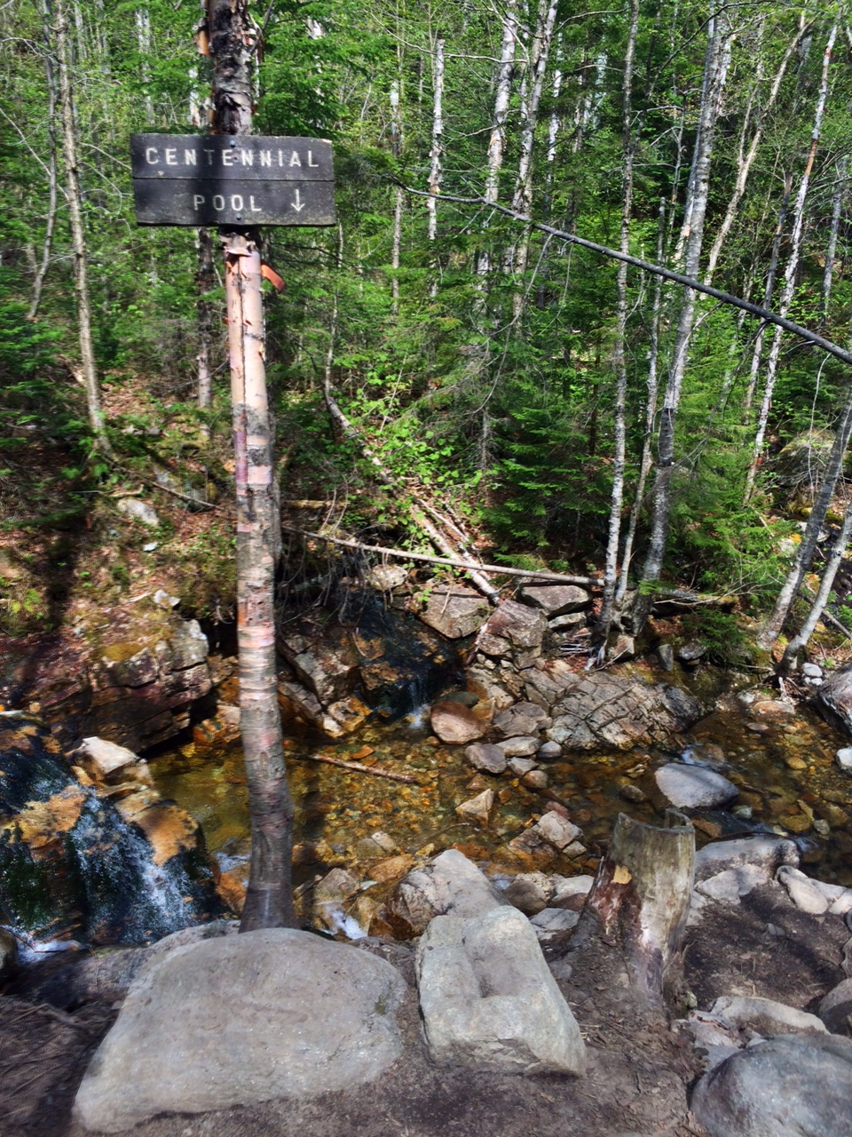
Centennial Pool
Trail:  This out-and-back trail starts with a stream crossing.  In summer, it's usually a fairly easy crossing, but I have experienced higher water (and wet feet) in the spring after snow melt.  The trail is an easy to moderate climb.  At 0.4 miles, you reach Centennial Pool - a little offshoot with a nice view of a small cascade and pool.  Continue 1.1 miles through hardwood forest.  Near the summit, the forest changes to short and crowded evergreens.

Final section of the trail
As the trail flattens out, you'll 'see the light' where the trail ends at a magnificent ledge looking down at Crawford Notch and Rt 302.  Although this is not a 360 degree view, it is by far one of the best in the area and definitely the best for such a short hike.  Pull out the map and try to identify all the peaks around you!  You can see multiple recognizable 4,000-footers - including Mt. Washington!

Difficulty: By White Mountain standards, this is an easy peak.  It is a great choice for everyone from families with small children to experienced hikers looking for an amazing view.  Be aware that there is a climb and that it involves a stream crossing.

Distance: 3.2 miles total (out-and-back)

Recommendations:

Summit View

- Although you can't see it, there is a popular rock-climbing route below the summit ledge.  DO NOT THROW ROCKS OR ITEMS OFF THE EDGE.

- Prepare for a stream crossing.  I use trekking poles to balance on the rocks to cross.

- Although it is a great family hike, adventurers should be prepared by bringing lots of water, snacks, rain/sun gear, and a first aid kit.  Anything can happen in the Whites.

- This is a very popular summer hike due to it's proximity to the Highland Center and its easiness.  Be prepared to interact with other hikers on the trail and summit.  Because of this, I didn't bring my dog Summit (although they are allowed).

Summit Selfie
- There are no bathrooms or water facilities at the trailhead, but you can get this (as well as advice, food, and lodging at the nearby AMC Highland Center.

- The summit/ledge is extremely dangerous.  Watch children and dogs carefully.


Although I'd hiked this trail many times, I still gasped at the view.  It is truly spectacular scene and a reminder why I love the White Mountains so much.  I can't think of a better hike to share with my infant son as his first "White Mountain Hike".


You Might Enjoy These Adventures As Well:

- 5 Best Family Hikes in the Whites

- Liebeskinds Loop, Lila's Ledge, and George's Gorge

- Welch-Dickey Loop