Showing posts with label Mountains. Show all posts

Wednesday, July 22, 2020

5 Miles, 3 Peaks, 1 Loop: Day Hike in New Hampshire's Lakes Region

New Hampshire Lake region hike

My summer quest to seek out new and beautiful hikes continues!  I "found" this hike by following another New Hampshire hiker on Instagram.  She showed photos of a loop hike that incorporated three mountain peaks - all with fantastic views of New Hampshire's iconic Lakes Region.  This is hike was an attractive choice for me for three reasons:

1. It's close(r) than the Whites (only an hour from the Seacoast)
2. It has amazing views of mountains and lakes from the peaks
3. It's a loop!!!

I found friends to tackle it with me on a hot and humid late June day.   I loved it so much...I did it again the next week!!

Here's how to recreate this adventure...

Adventure: Piper, Belknap, and Gunstock Loop

Getting there: The trailhead is located on Carriage Road in Gilford, New Hampshire.  To get there from the Seacoast, I drove west on Route 11 (Mt Major Hwy) from Alton toward Gilford.  From here, take a left onto 11A (Cherry Valley Road).  Drive about 8 miles and take a left onto Belknap Mountain Road.  After 1.3 miles, turn left onto Carriage Road.  After 0.4 miles the lower parking lot is on the left.  It has room for about 4 cars.  Parking is not permitted along the road.  When we got there the lot was full (weekday morning) but there is an overflow lot about a quarter mile (guessing) up the road on the right that can hold an additional 5 cars or so.  This is where we parked then walked down the road to the trailhead.
Standing on Piper Mountain
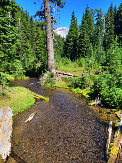
Standing on Summit of Piper Mountain
Trail:  The trail system is complex but well signed.  I recommend using a map or recording your trip through AllTrails.  We frequently double checked were on the right trail system.  I decided to take the trail clockwise- starting with Gunstock, then Belknap, then Piper.  
    The trail entrance to Gunstock Mountain is just at the lower parking lot.  It was actually kind of hard to find but it's just up hill from the large trailhead sign.  
    Once on the trail it was a pretty steady up to the Gunstock summit.  Before you reach the actual peak there's a nice viewpoint (with a picnic table) that overlooks the lakes.  At the summit you are reminded that this is a ski hill!  We saw another hiking group eating a snack in the shade of the chair lift.  There are fabulous views of Lake Winnipesaukee. 
    From Gunstock, go back into the woods and follow signs to Belknap.  The trail dips down gradually and then climbs again to get to Belknap Mountain - peaked with a climbable fire tower for the view!
To get to Piper Mountain, take the White Trail to the Old Piper Trail to Piper Mountain Summit.  This is a fairly bare summit and my favorite of the three.  I enjoyed wandering around to see views from all sides. 
Continue on the Old Piper Trail down to the parking lot.  
  
Difficulty: Moderate - The up and down make this a workout.  All Trails claims there is 1,827 ft of elevation gain in total which is nothing to squawk at!  Still, there is no technical skill needed for the climb (no slab or scrambling) - just good old fashioned up and down.  

sign on gunstock mountain trail

Distance: 5.5 mile loop

Recommendations: 

- I've done this hike twice in the last month.  The first time, I arrived on a sunny weekday around 10 am and the lower lot was full (4-5 cars).  There were still plenty of spaces in the upper lot (4-5 cars).  The street is covered with "No Parking" signs for over a mile, so if you want to guarantee a spot, get there early and avoid weekends.  The second time I went it was a cloudy/rainy day and there was no competition for spots.

- Use AllTrails to help guide your way.  There are a lot of side trails running in and out of Gunstock and Piper and a hiker could easily take the wrong trail.  All the trails are well marked, but unless you have a clear idea of which to take, I'd recommend the assistance of a map or technology.

- There are no bathroom facilities at the trailhead.

- This is a dog friendly trail.

My friends and I really enjoyed this loop.  If felt like we got so much bang for our buck!  I ended up going back the next week and did just the Piper peak in the rain with another friend.  What a difference the rain made - gorgeous bright green moss and trickling streams really gave the trail a romantic vibe.  This hike is one of my new favorites!
Views in Belknap Mountain Range

You might also enjoy these adventures...


Sunday, August 18, 2019

Summer 4000 footer - Mount Osceola via Trail on Tripoli Road

Back in May of 2015, I headed up to Tripoli Road to solo hike Mount Osceola.  Unfortunately, I discovered that in early May, the Tripoli Road is still "closed for winter" and I couldn't hike it.  I ended up taking the nearby multi-use Livermore Trail for a day hike and blogged about it.  It's now over four years later, but I decided to try again.  This time with my friend Kaley and her two dogs.

When looking for a hike to tackle today, I wanted something with a good view that wouldn't break us - neither had been doing strenuous hiking in the last couple months.  My choice was perfect! This moderate 4,315 footer is a steady out and back climb without any major slab or technical difficulty.  If you can just keep climbing up for 3.2 miles up and then back, you're in for the reward of spectacular views of the Sandwich Range.

View from Osceola summit.  Photo taken by my friend Kaley.

Here's how to recreate this adventure...

Adventure:  Mount Osceola via Mount Osceola Trail on Tripoli Road

Getting there:  We followed cell navigation to the trail head.  It took us a slightly different way than some websites but made good time and wasn't hard to find.  From I-93, take exit 28 for NH-49 toward NH 175/Campton/Waterville Valley.  Then turn right onto NH-49 E/State Hwy 49 E. In 10 miles, take a left onto Tripoli Rd.

Tripoli Road is only open in summer and is in moderately-poor condition for a paved road.  We dodged pot holes while slowly driving the couple miles to the Mount Osceola Trailhead.  There is a parking area but even by 9:00 am on a Sunday, it was full and we parked along the road with other vehicles.  There are outhouses at the trailhead as well as a parking fee (currently $5 a vehicle - bring exact change or check).
Roots and Birches

Trail: This is a moderate climb - especially for a White Mountain 4,000 footer.  The trail starts with a gradual climb and continues going up for the entire trek.  The ground cover changes back and forth from rocks to roots and packed dirt.  We were able to keep a steady pace without involving climbing or grabbing trees for support.  I really fell in love with the mossy rocks lining the trail in the hardwood forest.  As we gained elevation, we were able to see glimpses of the view through the evergreen branches.  The last mile of the trail was the most challenging - with slightly steeper grade and short slabby sections which were wet from the previous nights storm.  Still, nothing too intimidating.

Love these moss covered rocks
The view from the summit was beautiful!  The lookout is an open slap that gives you about a 180 degree view of the mountains south of the Kancamagus Highway called the Sandwich Range.  It was a moderately trafficked trail and there were probably 4-5 other groups up there enjoying the sunshine and view.  After a sun and snack break, we headed back down to the car the same way we had come up.  Some hikers decided to continue and bag "East Osceola" - another 4,000 nearby, but since it doesn't have a view, we weren't interested.

Difficulty: Moderate

Distance: 3.2 miles one way, 6.4 out and back

Recommendations:

- This would be a great hike for someone wanting to try their first 4,000 footer.  Although it was a steady climb with rocky trail, there were no technical skills needed.

- Remember your $5 for parking envelope.

- Don't make my mistake and assume the Tripoli Road is open in May. Summer only!

- This was a moderately trafficked trail and very dog friendly.  About a forth of hikers had dogs off leash.  Few asked if we wanted them to leash them.

Although I actually summited this mountain back in my guiding days, I had never taken the approach from Tripoli Road.  As a mom of a one and three year old, I don't get the opportunity often to take a full day to drive to the White Mountains and do a day hike.  I have to choose carefully!  This was the perfect hike for a summer day.

Please leave comments and questions below.  Follow us on Facebook at The Freelance Adventurer. or on Instagram @freelanceadventurer.


Steady uphill climb gave these rewards
Kaley's dogs - Dexter and Cooper

You might also enjoy the following:

- Mt Carrigain Loop - 4000 Footer and More

- Mount Pierce in Late Spring

- Advice For Hiking in the White Mountains

Monday, August 8, 2016

Sisters Wilderness - Green Lakes Trail near Bend

Waterfall off spur on Green Lakes Trail
On my recent Oregon trip, I was lucky enough to spend three nights outside of Bend.  My family rented a beautiful home on the Deschutes river.  We spent most of the time sitting on the porch, watching the lazy river take tubers and paddlers by our deck, and sipping on a glass of wine.  It wouldn't be a real Freelance Adventurer vacation, however, without a sturdy hike.  This time I went with my parents, husband, and baby to hike the Green Lakes Trail.  This 9.3 mile out-and-back trail was a little too much for a 90 F afternoon, but we did enjoy over two miles in with views of river, waterfalls, and mountains which made the perfect hike.

Here's how to recreate this adventure...
Trailhead

Adventure:  Half Way Up the Green Lakes Trail (and back).

Getting there: The Green Lakes Trailhead is located 27 miles west of Bend on Century Drive.  It has a large parking lot (and overflow lot) but the lot is not marked.  There is an outhouse and well marked trailhead at the end of the parking lot.  Visitors must have a national forest parking pass.

Trail: The trail starts from the parking lot.  There is a sign that marks the way.  We initially crossed Fall Creek on a log bridge and then steadily walked uphill.  The moderate trail was dusty and graded.  There were few obstacles.  It winds through a pine forest and stays parallel to the river.  After about 30 minutes of walking (maybe 0.5-1 mile up), we took a spur path on the right to see an impressive waterfall.  The spur was not marked, but listen for the water noise increase (it wasn't visible from the trail).  The steep 50 ft spur trail takes you down to the base of the falls.  The spray felt AMAZING on the hot day.  Continuing back up, we reached the intersection of Moraine and Green Lake Trail at 2 miles.  We went a little further and were rewarded with views of a meadow, wildflowers and nice views of Broken Top Mountain.  After a water and snack break we decided to head back.  All-in-all I think we did about 5-6 miles.  It was a wonderful hike and I'd love to go back and make it to the lakes!

Horses and Dogs are allowed on the trail.


Log Bridge at start of trail
Difficulty:  Moderate

Recommendations:

- Bring lots of water!  We traveled on a July day that started in the 60s and ended in the high 90s.  It was dry and hot!  There was no water available for refill at the trailhead.

- Get to the trailhead early.  It was a popular hike and even at 10 am the parking lot was packed.

- Dogs and horses are allowed.


We loved our family hike with three generations!  It was a great way to enjoy central Oregon Cascade views and get outside!


Fall Creek and South Sister in the Background
View of Broken Top Mountain

You might also enjoy these adventures:
Crossing another log bridge


- Crossing the Cascades

- Oregon Coast Day Trip

- A Day at Cannon Beach

- Portland, Oregon - Bikes, Beers, and Baristas


Fall Creek Cowboy

Monday, February 8, 2016

Liebeskind's Loop, Lila's Ledge, and George's Gorge in Winter


View from Lila's Ledge of Pinkham Notch, NH

I guess I should apologize... I've been off the blog for a few months.  For those of you who don't know, I'm in the third trimester of a pregnancy and that, combined with the poor snow season, has kept me out of the White Mountains and instead exploring hikes near home.  This weekend however, I did manage to get up north for a birthday hike.  Due to my current preggo-state, I opted for a shorter hike that still promises awesome views and a moderate challenge.  This approximately two mile loop provides great views of Wildcat Mountain, Pinkham Notch, and Tuckerman's Ravine.  In winter, you have the additional benefit of little to no crowds and clearer views between leafless trees.

Here is how to recreate this adventure...

Adventure: Leibeskind's Loop, Lila's Ledge, and George's Gorge
Trail through George's Gorge

Getting there:  The trailhead is located at the AMC Pinkham Notch Visitor Center on Rt 16.  From North Conway, take 16 North.  At the 302/16 light, turn right to continue on 16.  Drive 20 minutes and the visitor center will be on the left.  Walk past the visitor center to the main trailhead sign and continue straight onto Old Jackson Road/AT.

Trail:  From the AMC Pinkham Notch Visitor Center, take Old Jackson Road (AT) 0.3 miles to the junction with the Crew Cut trail.  This is a wide, gentle incline and popular trail.  After the small footbridge, take a right onto Crew Cut trail.  The Crew Cut is a narrow offshoot.  It winds up for 0.3 miles passing the left hand entrance of George's Gorge trail.  Continue straight and follow signs to Lila's Ledge.  It is a 0.1-2 offshoot from Crew Cut.

From Lila's Ledge, you can see Wildcat Ski area, Pinkham Notch/Rt 16, and Mount Washington via Tuckerman's Ravine.  It's a GREAT view for such a short little hike.  Return back to Crew Cut and from here, take Liebeskind's Loop Trail to start looping back.  This 0.5 mile section winds up and down along tall rocks and on narrow trail.  You will pass a viewpoint named Brad's Bluff that give more magnificent views of Mount Washington before reaching the George's Gorge Trail.  From here, you can either continue 0.3 miles uphill back to Old Jackson Road trail or take a left and return via George's Gorge (0.5 mi) to the original Crew Cut/Old Jackson Rd section.
Icy Trail

On this day, we decided to get back to Old Jackson Road quickly since many portions of the narrow loop were very icy.  Back on Old Jackson Rd, we enjoyed the leisurely, wide trail back to Pinkham Notch Visitor Center.


Difficulty:  For this area of the White Mountains, this trail is Easy-Moderate.  However, on this day, there had been little snow and the trails were sheets of ice in many places which made it increasingly difficult even with proper traction.  Be sure to come prepared with proper winter gear.

Distance: 2-3 miles (depending on which offshoot/loop you do)


Recommendations: 

- This is a great little hike near the visitor center.  In the summer, it's a perfect stroll for families or someone looking for a short hike with a great view.

- Lila's Ledge is a dangerous overlook - especially in winter.  Watch your dogs, children, and yourself when navigating onto the ledge.

- In winter, weather conditions can change quickly in the notch with little warning.  Even for a short hike, plan ahead and be prepared for ice, snow, wind, and rain.  We wore multiple (non-cotton) layers, winter boots, microspikes, ski poles, and packed a winter emergency kit, AMC Presidential Map (#1), water, and snack.

- Warm up afterwards in the AMC Pinkham Notch Visitor Center with some hot chocolate or coffee. Get advice from the AMC guides and employees on winter conditions.

This was a great way to spend my birthday and finally get up to the White Mountains for a little adventure.  Even 7 months pregnant, I was able to get great views of notch and some of my favorite peaks.

Visit to Sabbaday Falls later that day

You might enjoy these winter hikes as well...

Carter Notch Hut in Winter

Skiing the Sherbie

Cold Night on the Mountain

Please leave comments or questions below or visit our Facebook Page.


Saturday, September 26, 2015

Mt. Carrigain Loop - 4000 footer and more

View of Mt. Carrigain summit as you approach from Signal Ridge Trail

A perfect fall day was improved by a White Mountain hike with two of my favorite girls.  We started the adventure with a plan to summit the 4700 ft Mt. Carrigain as an out-and-back hike.  Once on the summit, the ideal weather made us long for more, so we continued down Desolation Trail to Carrigain Notch Trail - making a sweet 13.5 mile loop.  It was a great way to enjoy the mountains, views, and friends.

Adventure: Mt. Carrigain Loop

Trailhead across from parking lot.
Getting There: From southern New Hampshire, we took Highway 16 north to North Conway.  Here we took Rt 302 North/East towards Crawford Notch State Park.  Just after the town of Bartlett, take a left on Sawyer River Road (closed in winter).  The road is across from Fourth Iron Tentsite and if you enter Crawford Notch State Park, you've gone too far.  Drive up Sawyer River Rd about 2 miles.  A signed parking lot is on the left and the trail is on the right.  There are no bathrooms and no cell service at the trail head.


Trail:  The adventure starts with Signal Ridge Trail.  The trail parallels a brook and is relatively flat for the first couple miles.  It winds through beautiful hardwood forest.  At 1.7 miles, you reach the junction for Carrigain Notch Trail.  Stay left to summit.  As we continued, the trail rapidly changed to a steady uphill climb.  The hiking isn't difficult (no slab or boulders), but the constant up can be very tiring and strenuous.  From the junction, continue 3.3 miles until you reach the summit.  Hikers can climb the fire tower for a 360 degree of the Pemigewasset Wilderness.

Summit of Mt. Carrigain
After enjoying our lunch in the sun, we decided to continue our adventure by making our hike into a loop (adds 3.5 miles to the previously planned out-and-back).   Desolation Trail was a steep grade - narrow, mossy rocks made for a slow and cautious decent.  At 1.9 miles Desolation reaches Carrigain Notch Trail.

Continue along Carrigain Notch Trail over a relatively flat path.  We crossed streams and were surrounded by more hardwood forest.  There were few other hikers on the remote trail and we enjoyed the solitude and easy hiking.  After 4.1 miles on Carrigain Notch Trail, you meet back with Signal Ridge Trail.  Take the 1.7 flat trail back to the parking lot.   It was a wonderful long loop and I highly recommend it!


Difficulty: Moderate - Difficult.  The trails themselves aren't too bad (although Desolation had it's difficult moments), but the long trail and sustained hiking makes this day hike for experienced hikers only.

Descent on Desolation Trail
Distance:  13.5 miles for complete loop.  10 miles for an out-and-back to Mt. Carrigain.

Recommendations:  

- Even though half of this loop is on flat ground, two of us ran out of water on the last couple miles.  Bring over 2 liters when traveling over ten miles.

- There was no cell service at the parking lot or along the hike.  Make sure loved ones know where you have gone and when to expect you back.

- There are no water or bathroom facilities at the trailhead nor along the hike.  Plan ahead and be prepared.

- Sawyer River Road is closed in winter.  Be aware of road conditions if planning your hike for late fall - early spring.

Summit the Dog on Carrigain Notch Trail


I LOVED this hike with my friends Courtney and Ingrid.  I'm so grateful to have friends who share my love of nature and the great outdoors.  Consider this for your next big day hike!


Please leave comments and questions below.  Don't forget to visit us on Facebook at https://www.facebook.com/TheFreelanceAdventurer

Best of Friends on the Mt. Carrigain Fire Tower!

You might also enjoy...

Mt. Moosilauke - Moderate Hike for a Major View

Butt Burner in the White Mountains - Mt. Flume to Mt. Liberty

Mt. Pierce in Late Spring

Sunday, July 19, 2015

Day 12 - Southeast Iceland - Icebergs and Glaciers

Jökulsárlón / Glacial Bay
Just when we thought we'd seen all Iceland had to offer, it shook our soul again.  We witnessed a glacial bay, black beaches with washed up icebergs, a waterfall surrounded by basalt columns, and lava rock monoliths in the ocean.  Here is how to recreate this adventure...

Day 12 - Southeast Iceland - Icebergs and Glaciers
Icebergs, Mountains, and Glaciers...oh my!

After a delicious continental breakfasts at Guesthouse Arnanes, we got on the road and drove the Ring Road (Rt 1) south to Jökulsárlón Bay.  Jökulsárlón is a glacial lagoon located at the head of the Breiðamerkurjökull glacier which is part of the larger Vatnajökull glacier and national park.  As the glacier recedes, it releases icebergs into the lagoon.  Because of increased melting due to climate change, the lagoon's size has increased greatly in the last decade.  Calved icebergs float through the lagoon, through the mouth of the bay, and are released into the ocean. Many wash up on the nearby black sand beach.

Black Sand Beach with Icebergs 

Glacial Bay
We arrived at Jökulsárlón early in the morning to rain and cloudy skies.  The view was still overwhelming - thousands of small icebergs literally filled the lake.  So full, in fact, that we were informed that due to the large amount of icebergs, our boat tour would not be going out that morning.  No boat trip and rainy day aside, we marveled at the amazing location and it's awe-inspiring landscape.  A short walk down the mouth and we got to walk along a black sand beach dotted with washed-up iceberg bits.


Not only was the geological setting impressive, the biological was as well.  Rare seabirds like arctic terns floated out to see on ice platforms.  We saw our first seals of the trip swimming in between the car-sized pieces of ice.  As we absorbed the scene, the sun came out and we were treated to a sun-kissed lagoon.

Amphibious Boat Tour 
On our return to the parking lot from the beach, we saw people waiting in line at the boat trip ticket booth.  WHAT?!  We discovered that the boats were now going out. We signed up for an afternoon half hour amphibian boat tour.  In the meantime, we killed time by strolling around the lagoon and enjoying a lunch of fish soup at the gift shop.

The boat tour was great!  We were able to putt around the bay, admiring the glaciers, mountains, and icebergs.  The boat also had a guide give a short interpretive presentation about the history of the bay and icebergs in general, which included scooping out a piece of ice for everyone to try.  This place was definitely one of my favorite parts of our two week trip.

Svartifoss Waterfall
Our day continued by driving from Jökulsárlón to Skaftafell National Park.  This park is home to mountains, waterfalls, and glaciers.  From the park headquarters we hiked up the 30 minute moderate walk to Svartifoss waterfall.  The trail was crowded.

Now that we were southern Iceland and closer to the airport and Reykjavik, we had started seeing many more people.  Crowded parking lots and trails were almost a culture shock after days of rural drives.  The waterfall was beautiful and we enjoyed the warm sunshine.

We stopped in the town of Kirkjubæjarklaustur to see what the tour book called the "church floor".  It turns out this is not a church floor at all but a flat columnar basalt rock formation.  It was a pretty site and a short (5 min) walk from the parking lot.
"Church Floor" Rock Formation"
There were still more sights to see! We took a detour off the Ring Road to Rt 206 to see Fjaðrárgljúfur canyon.  This 2 km long canyon is 100 meters deep and ABSOLUTELY BEAUTIFUL.  It took about 30 minutes to casually walk the length of it.  You'll see off-shoots where daredevil hikers have precariously walked to the edge.  Photos cannot even show its loveliness.

Fjaðrárgljúfur

Vik / Myrdalshreppur Beach
It was getting late.  We stopped for dinner at the Black Beach Restaurant in Mýrdalshreppur.  Talk about location!  The cafe has 75% glass walls that overlook the black beach and picturesque lava rock formations. The food was good as well.  We finished dinner and walked the beach - marveling at the columnar basalt cliffs, black pebble beach, and seashore rock pillars.

Done for the night, we headed to Hotel Edda Skogar.  Little did we know, our hotel was adjacent to one of Iceland's most impressive waterfalls - Skogafoss!  We watched the sun "set" behind the mountain and falls before heading in for a late night.

Vik / Myrdalshreppur Beach
This has got to be one of the longest, yet most fulfilling and exciting days we had in Iceland.  From glaciers, to icebergs, to beaches, and waterfalls - the Southeast is truly a magical place.  I highly recommend visitors make the time to explore this amazing area.

Skogafoss Waterfall at midnight
READ ABOUT THE NEXT DAY HERE: Day 13 - The South Coast - Waterfalls, Waterfalls, and Snorkeling

Please leave comments or questions below, or visit us on our Facebook page at The Freelance Adventurer for more photos and stories or visit us on Instagram @FreelanceAdventurer.

Friday, July 17, 2015

Day 10 - Myvatn - Craters, Sulfur Pots, and Steam Vents

Myvatn Geothermal Area
What a day!  Exploring the Myvatn area was like stepping onto another planet.  Steam blasted into the air through cracks in the crust.  The ground was cracked and folded like poorly rolled pavement.  Craters rose out of the mist across the land.  It was clear to see the earth was alive.  Here's how to recreate this adventure...

Day 10 - Myvatn - Craters, Sulfur Pots, and Steam Vents

Pseudocraters on Lake Myvatn
The day started with enjoying a wonderful continental breakfast at Guesthouse Stöng before heading out to explore the Myvatn area.  Myvatn is a large lake located in northern Iceland.  The lake was created by a large eruption 2,300 years age.  The explosion created a volcanic landscape of pseudocraters, lava rock formations, and calderas.  The lake itself is an important bird and fish habitat.

Our first exploration was to take a short hike at Kálfaströnd to observe the lake and surrounding pseudocraters (rootless cones created from steam eruptions).  We also got to see some arctic terns and other waterfowl.
Lava Rock Formations in Dimmuborgir
We continued to Dimmuborgir - a large lava field covered in tall, unique formations.  Ali wasn't feeling like hiking so she agreed to be our shuttle.  She dropped us off at Dimmuborgir, and we followed the trail system through the lava fields and over to Hverfjall crater.  This impressive cone looks like a massive pile of black lava rock...and essentially, it is.  From the Dimmuborgir, we were able to scramble up a steep trail to the ridge of the crater.  It was a tough climb but worth it.  From the top, we could stare into the crater and walk the edge toward the Hverfjall parking area.  The approach from the opposite side was not as difficult, and we were easily able to get back down to Ali.
Leanne climbs up the Hverfjall crater.
Hverir
Next, we headed to the town of Reykjahlíð to gas up and grab lunch at the supermarket.  After a quick break, we headed on to Hverir - a geothermal area with bubbling mud-pots and steaming fumeroles.  Walking around Hverir was like stepping onto another world.  The ground was red and brown and lacked any vegetation.  Hot steam shot out of vents in the ground and the entire place smelled strongly of sulfur.  Visitors were free to meander through the area with signs alerting them to hot temperatures and danger.  It was similar to some things I've seen in Yellowstone National Park.  This place was truly an amazing sight.

We continued to Viti Crater.  Viti in Icelandic means "hell" and although it might have caused hell in 1734 when it erupted, Viti looks nothing like it now.  The perfectly round crater is filled with turquoise water.  Ice sheets were still present in part of the rim in summer.  We enjoyed walking the rim and admiring the surreal landscape.

Viti Crater
Detifoss


With still more to see and a long drive ahead of us, we reluctantly left the Myvatn area.  Our next stop was the formidable and famous Detifoss waterfall.  Detifoss is the largest waterfall in Iceland according to volume of water that discharges over the falls.  It was a 5-10 minute walk from the parking area to the falls.

What power!  We marveled at the impressive falls and when the sun broke out, got a glimpse of a waterfall across the canyon.  Before leaving, we also strolled down to Selfoss, a smaller, but still beautiful, waterfall upstream.


Rainbow over Detifoss
Back on the Ring Road (Rt 1), we cruised to the town of Egilsstaðir.  We stayed at Icelandair Hotel Herad.  This was a nice hotel and we enjoyed happy hour in the hotel bar before heading out for a terrific dinner at Cafe Neilsen.  We also grabbed soft serve ice cream (another Icelandic ironic favorite) at Salt.
Selfoss is upstream from Detifoss

Our day in Myvatn and Detifoss was nothing short of amazing.  The geothermal activity and stark landscape makes Iceland incredibly special.  It's a shame that most tourists don't have the time to drive up north to these treasures.  They are truly a wonder to behold.

Please leave comments or questions below, or visit us on our Facebook page at The Freelance Adventurer for more photos and stories or visit us on Instagram @FreelanceAdventurer.


Scortched Earth
READ ABOUT THE NEXT DAY HERE: Day 11 - East Iceland - Hot Tubs, Lobster, and (more) Waterfalls

Tuesday, July 14, 2015

Day 7 - Northwest Iceland - Black Beaches, Driftwood, and Icelandic Horses

Horseback Riding in Varmahlid with Hesa Sport.
After three days of exploring the wild Westfjords, on day 7, we returned to the Ring Road.  Our drive was gorgeous - fjords, mountains, and seashore.  An evening of riding Icleandic horses by waterfalls, farms, and mountains rounded out another beautiful day.

Day 7 - Northwest Iceland - Black Beaches, Driftwood and Icelandic Horses

Wood that drifted from Siberia.
We hit the road early, heading out of the Westfjords on Rt 68.  The drive had a large amount of gravel/dirt road but was fairly straight and manageable.  Along the coast, we saw piles of driftwood - a confusing sight since there are very few trees in the country.  A tour book informed us that the wood travels all the way from Siberia and collects on the northern shores of Iceland.  Crazy! 

We stopped for lunch in the town of Hvammstangi.  After enjoying our picnic lunch outside the Seal Museum, we got instructions to drive out to Hvítserkur - a unique and scenic seashore rock formation. 

Hvitserkur Beach
The road to Hvítserkur is dirt/gravel and passed sheep and horse farms.  There is a short trail to a viewing platform.  From here, we decided to stumble down the steep but short trail to the beach.  The isolated beach of black sand stretched for as far as the eye could see and herds of Icelandic horses ran free over the cliffs. It was a little piece of heaven!

Our next major stop was in Varmahlíð where we had scheduled an evening horseback riding trip with Hesta Sport.  We got there early, so we drove down the road to a turf church in town.  It charged for entrance so we just observed the outside.  

At Hesta Sport, we watched a 30 minute movie about the area and the Icelandic horse before heading to the stables.  We had signed up for a three hour River Delta tour. We were the only ones on our tour and our two young guides were professional and informative.  It was wonderful to see the countryside on horseback.

Icelandic Horses running alongside our car.
Our cabin in Holar.
It was late when we finished our tour.  We grabbed a dinner of burgers and fries at the service station in Varmahlíð before driving to Holar where we checked into Ferdapjonustan Holum - another converted dorm residence.  The location of this guesthouse was beautiful - nestled in a quiet valley between mountains.  We were placed in a small cabin with three beds, a kitchen, a bathroom, AND a small washing machine!  It was a relief since we had only brought one week of clothing for our two week trip and hadn't seen laundromats on our travels.  We did two loads of laundry and left the items hanging in the apartment overnight to dry.  

It was another long, but enjoyable, day in Iceland.  
Horseback Selfie
READ ABOUT THE NEXT DAY HERE: Day 8 - Akureyri - Shopping, Food, and Drink

Please leave comments or questions below, or visit us on our Facebook page at The Freelance Adventurer for more photos and stories or visit us on Instagram @FreelanceAdventurer.