Showing posts with label Washington. Show all posts

Sunday, August 20, 2023

Girls Trip 2023: North Cascades and Mt Rainier Loop - Hiking, Camping, and Sightseeing

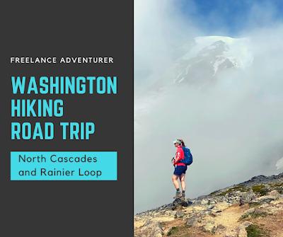
Hiker with a cloudy Mt Rainier behind.  Text reads Washington Hiking Road Trip - North Cascades and Rainier Loop

 It's that time of year again... GIRLS TRIP!  Leanne and I are far from "girls" its seems as 40-year-old women, but we still have been having this traditional trip since 2007!  With my parents in Portland, Oregon willing to watch the kids for a week, I looked for a trip that would be easily accessible from this site.  Never having been to North Cascades National Park nor Mt Rainier National Park, I decided to plan a camping/hiking trip that visited both parks with the bulk of the trip centering around some intensive day hiking in North Cascades.  As it seems to happen to us a lot, our plans were sadly changed when fires broke out the day before we entered the park and escalated - forcing us to evacuate and change our plans a bit.  We rolled with it and it still turned out a great trip.  Here's our *revised* itinerary.

Here's how to recreate this adventure....

Day 1: Pick up Campervan in Portland, Oregon and Drive to Olympia, Washington

We started by renting a camper van out of Portland, Oregon. Unfortunately, we didn't love the van so I'm not going to name drop (feel free to DM me on instagram for the name). But it had over 300,000 miles on it, broken hubcaps, dirty, and overall beat up. (Spoiler: it made the trip) However, I wasn't pleased.  Either way, we picked it up and drove north.  Our first night camping was at a private campground in Olympia that was meant to break up the drive. The campground was called Riverbend.  Tent sites were large, private, and had a great waterfront access.  There was a flush bathroom on site but it was a bit of a walk, however, each tent site had it's own porta potty too! We made dinner, enjoyed the river view, and spent our first night figuring out the van bed. 

Day 2: North Cascades - Visitor Center, Set up Camp, Short Hikes

We had a leisurely morning, then took off to North Cascades National Park.  We stopped at the visitor center near Newhalem, got a park map, bought some souvenirs, then took off to do a set of short hikes before reaching our campground.  Here are some great small hikes to do when you first arrive:

- Stirling Munro Trail: This short but scenic boardwalk trail is only 300 feet long.  It weaves through trees to a mountain overlook and departs directly behind the Visitor Center.

- Trail of Cedars: This short and easy 0.6 mile out and back trail weaves through Cedar giants, along the shores of the glacial blue Skagit River. 

- Ladder Creek Falls: Though only 0.5 mile loop, this trail is steep.  It crosses a bridge and climbs behind the Newhalem Gorge Powerhouse to Ladder Creek Falls - small, yet beautiful waterfall.

- Gorge Overlook Trail: This 1/3 mile loop trail climbs to give views of the Gorge Dam and Ross Lake.*Here we got our first glimpses of (at that time) a very small wildfire on the hill across.

After we finished these hikes, we checked into our campsite at Colonial Creek South Campground.  We booked this site exactly 6 months prior to arrival - the soonest offered.

Happy to be in North Cascades National Park!

Day 3: North Cascades - Maple Pass Loop and Rainey Lake

- Maple Pass Loop: Today was about a very special hike.  I was dying to hike Maple Pass Loop.  We woke up to a smoke campground and drove east, hoping to escape the bad air on our big hiking day.  We had read that this was a popular hike so we arrived at the trailhead around 8 am and found plenty of parking.  While the hike started smoky, we soon hike above the smoke and had clean air, blue sky, and perfect hiking weather.  We tackled the loop in a counter clockwise manner, which we were happy with.  The hike was moderately challenging, and extremely rewarding.  We got to back to the van around 2pm where we switched shoes and hit up one more little hike.

- Rainey Lake Trail: This trail is 2.0 out and back to the clear blue Rainey Lake.  The ADA trail meanders through flat forest, then emerges on a viewing platform.  We cooled our feet in the water before heading back to the car and campsite.

On the drive back to the campsite, we saw views of the growing smoke and fires erupting from the shores and Sourdough Mountain on Diablo Lake - just a couple miles from our campground.  It was eerie and nerve-wracking.

Maple Pass Loop Views

Leanne hiking along Maple Pass Loop in North Cascades

Day 4: North Cascades - Blue Lake, Washington Pass Overlook, Cutthroat Lake, and Winthrop

Again, we decided to drive east, this time, not only to escape smoke put also to end in the town of Winthrop where we could resupply on ice. The smoke had blown through the cascade valley and unfortunately our entire day air quality showed evidence of the fires back on Diablo. Our hikes and stops included:

Blue Lake Trail: This 4.6 mile out and back trail was a relatively easy to moderate trail that rewarded with beautiful forests, mountain views, and a beautiful alpine lake.  This trail was crowded and busy at the lake.

Washington Pass Overlook: This overlook was our picnic lunch spot, and also included a 0.3 mile steep, yet paved overlook trail that awards is stunning views of Washington Pass and the twisted road below.

Cutthroat Lake Trail: This 3.8 mile easy to moderate trail had views of rising peaks on either side and ended at a solitude lake.  We had to drive a bumpy forest road to get to the trailhead, but the van handled it fine. We started this hike at 4:30 pm and saw few other hikers.  The views were beautiful but the air quality provided a reminder that the park was suffering. 

From this hike we drove another 30 minutes from Cutthroat Lake to the town in Winthrop where we planned to sightsee, grab dinner, and resupply.  Shockingly, when we returned to "service" we discovered the campground and highway 20 had been closed due to the fire and we were suddenly without a campsite.  While the letter said we could get our "stuff" until 10 pm at night, at that point we were 1.5-2 hr drive from the campsite and it was already 7:30 pm.  We decided to abandon our items (laundry line, table cloth, and some food in the bear box) and stay put.  I got us a last minute waterfront tent site at the Winthrop KOA and we hit the town.  We enjoyed walking the cute western town, grabbed burgers at the burger bar, ice cream, and settled in - trying to figure out our next plan of action.

Observing Fire-fighting efforts.  Thank you firefighters!
Winthrop's Western theme was adorable!

Day 5: Drive Winthrop to Leavenworth to Snoqualmie

Unfortunately, now it was a Saturday and we were striking out on finding a campsite as we meandered south toward Rainier.  Fortunately, a family friend offered her home!  Even though they weren't in town, they gave us access to their house in Snoqualmie and we slept in the van on their driveway.  We took off from Winthrop in a cloud of horrible air quality which continued for hours into our drive.  Looking to make the most of this new roundtrip, we decided to stop in the Bavarian-themed tourist town of Leavenworth for lunch.  It was rainy when we arrived, yet still enjoyed sightseeing and window shopping.  We waited in line for about 30 minutes to get a bratwurst and pretzel at München Haus, followed by pastries at the Danish Bakery. We had planned to hike near Snoqualmie, but it continued to rain and we just weren't feeling it.  We settled in at our friends, took much needed showers, visited a local gem and rock shop, then made our camp dinner in their kitchen.

Leavenworth is a Bavarian themed town in Washington.  We loved it!

Day 6: Mt Rainier - Longmire Area

Since check-in at our Rainier campground wasn't available until 1 pm, we had a leisurely morning and had a short (and very steep) hike:

Snoqualmie Falls: This was a 1.4 mile out and back paved trail through forest descending from the top parking lot to the bottom of the falls.  AllTrails says its 331 ft elevation gain which isn't too bad but it felt steep!  

Snoqualmie Falls

We drove to our next campground - this was a delight!  Elkamp campground was small and wooded with mossy cedars.  A brook ran next to our tentsite with a meadow and mountains behind.  It was only 30 minutes to the Longmire Visitor Center in Mt Rainier.  After setting up camp, we drive through the Nisqually entrance and to Longmire.  We visited the visitor center and did the following hikes in the area for the rest of the day:

- Trail of Shadows- This 0.7 mile loop is an easy trail of packed dirt and boardwalk.  It passes through a large forest with nurse logs, towering trees and marsh.

- Comet Falls Trail - This 3.8 out and back trail leads to the beautiful Comet Falls.  The trail climbs 900 feet in elevation on packed trail, some rock, and even a ladder.  AllTrails rates it as hard.  We saw gorgeous waterfalls, pika, marmots, and deer!  We arrived at the falls (one of the tallest in the park) at 5:30 pm.  We enjoyed taking photos, soaking in the views, then headed back down.  

We saw the sunset as we drove back to Elkamp, had a late dinner and prepared for an early morning hike the next day.

Comet Falls in Mt Rainier near Longmire area

Day 7: Paradise in Rainier: Skyline Loop and more

Today's goal was to hike the Skyline Loop.  The weather continued to mess with us.  After weeks of clear weather, both days we were in Rainier had horrible rain/fog forcasts.  However, we decided to try anyway.  Nervous about parking, we got to the Paradise Visitor Center Parking around 7 am and scored a spot in the first row.  Woohoo!  Banked in thick fog, it seemed silly to start the hike. I snoozed in the van while Leanne packed a trail lunch.  Around 9:30 am, we donned our rain gear and set out on the trail, doing it clockwise.

- Skyline Loop - Skyline Loop might go down as one of my favorite hikes of all time.  I can see why it's so popular.  It has everything in summer - glaciers, mountain views, gorgeous waterfalls, and even epic waterfalls - all in 5.5 miles.  The first part of the hike was all in fog and rain - however, not far after the glacial vista turnoff, we got a few "peeks" of Mt Rainier.  A few more showed up (although Panorama Point was in the clouds), and got a few fun photos with the volcano.  As we hiked the downside, I loved the glaciers and flowers.  We got lucky that the opposite ridge cleared and we enjoyed gorgeous mountain views throughout our descent. With all the stops and crowded trail, we didn't get back to the van until 2:30 pm.  

Our view of Mt Rainier through the clouds.

Not wanting the day to end, we got ice cream at the visitor center cafe, rested in the sun, toured the visitor center, and headed out on another little trail.

- Nisqually Vista Trail - Wanting to continue our experience, we hiked the 1.1 mile Nisqually Vista Trail near the visitor center.  It traveled through lichen adorned forest and (had the mountain been visible) a a nice view of Mt Rainier.

- Reflection Lake - We packed up the van and made one last stop.  We hit up Reflection Lake about 30 minutes prior to sunset hoping the mountain would emerge out of the clouds.  It never did, but the lake was beautiful and we enjoyed walking the short trail around half of it.

We returned to Elkamp and crashed for the night.

Day 8: Return the van

We had to have the van returned to Portland at 10 am.  So, we got up early, packed up and drove back. Returning the van was easy.  I was incredibly relieved the van survived the trip.

In summary

Even with the rickety van, wildfires, and canceled plans - I really enjoyed this trip.  It was definitely "hiking heavy" which was the intention.  Maple Pass Loop and Skyline Loop goes down as top ten hikes of my life.  If you have questions about the trip or want to see more photos, visit my instagram and DM me on here!

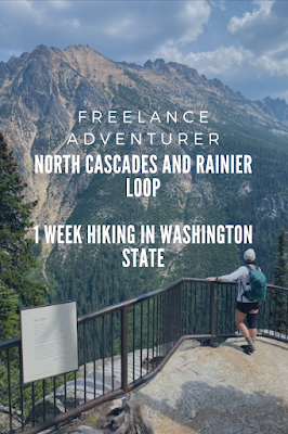
Woman looking out at view of mountains in North Cascades National Park at Washington Pass Overlook.

Here are some other similar adventure trips you might enjoy:

LA to Colorado - Hiking and Adventuring

Michigan Nature

Newfoundland


Thursday, November 21, 2019

Mount Washington in Fall

We weren't planning on summiting that day.  My parents had agreed to watch the kids while we took an "adult hike".  I let my husband choose - knowing he would pick something around Mt. Washington - his favorite peak.  We started from Pinkham Notch Joe Dodge in the clouds and fog.  The visibility in Tuckerman Ravine was awful, but wanting to get a little more exercise we decided to climb the Boot Spur Link up to Boot Spur Trial.  As we continued along the ridge, I heard Matt call "LOOK!".  The clouds parted and we were soon looking at Mt. Washington with a backdrop of blue.  Below us the under-story of clouds provided a blanket over the valley.  It was then we decided to go for the summit.
Boot Spur to Tuckerman Ravine Trail

Here's how to recreate this adventure...


Adventure:  Mt.Washington summit loop via Tuckermas, Boot Spur, Davis, Tuckermans, Nelson Craig, Alpine Garden, and Lion's Head.

Getting there: Our adventure began at AMC Pinkham Notch Visitor Center.  To get there, take Route 16 north out of North Conway.  At the 302/16 intersection, turn right to stay on Route 16.  About 11 miles from the intersection you will reach the visitor center on the left.  There is a large parking lot, AMC visitor center/dining hall and Joe Dodge Lodge.  The Tuckerman Ravine trailhead is located directly behind the main visitor center building with a well marked sign and is the starting point for many of the other trails that come off it.
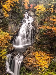
Crystal Cascade on the Tuckerman Ravine Trail near Pinkham Notch Visitor Center.

Trail: This hike involved many trails.  There are numerous stories of people who have gotten lost in this region.  It is important to use a AMC trail map (available for purchase in the visitor center) and familiarize yourself with it before departure.  Below is the way we took...

Part 1: Visitor Center to Hermit Lake Shelter
We started by taking the Tuckerman Ravine trail from Pinkham Notch.  This trail is wide, a steady uphill, and uneven terrain.  My mom once asked "Is this a dried up river bed?" and that statement perfectly describes the trail.  Along the way, enjoy views of Crystal Cascade - a photogenic waterfall.  This section is 2.4 miles one way and ends at a shelter deep in Tuckerman's Ravine.

Part 2:  Hermit Lake to Boot Spur
From Hermit Lake Shelter, we took the Boot Spur Link...up.  I've taken this trail with Matt a few years ago, and we took it down.  It's one of the steepest trails I've ever done in the White Mountains and not for the weak knees.  When you get to the ridge, the link meets up with Boot Spur Trail.  Continue up the Boot Spur trail until you at the Davis Path intersection. This section is 1.3 miles.

Part 3: Davis Path to Tuckerman Junction
From Boot Spur, take the Davis Path toward the summit.  This exposed rocky trail is marked with cairns.  Turn right at the Lawn Cutoff and continue towards the summit.  Clear days provide stunning views of Mt. Washington's summit and surround ridges.  The Lawn Cutoff ends at Tuckerman Junction where five points of trail meet. This section is 1.0 mile.

Part 4: From Tuckerman Junction, take Tuckerman Ravine Trail the last half mile to the summit.  This steep climb is covered in boulders and extremely exposed and steep.  Emerging at this peak can be somewhat anticlimactic since the Auto Road and Cog railway brings non-hiking tourists to the summit it can be crowded and busy.  This section is 1.0 mile.

View of the Mount Washington summit from the top of Boot Spur


After a warm beverage and bathroom break in the summit's visitor center, we headed back down a different way.

Part 5: Nelson Craig Trail to Alpine Garden
From the summit, we took the Nelson Craig Trail which parallel's the Auto Road.  At the Huntington Ravine Trail, we turned right for a short distance until it met with the Alpine Garden Trail. Huntington Ravine Trail is dangerous and never recommended for decent. We decided to take the Alpine Garden trail which cuts back along the ravine and reconnects with Lion's Head trail and Tuckerman Ravine Trail. This section is 1.9 mile.

Part 6: Lion Head Trail to Tuckerman Ravine Trail
After 0.9 miles of the Alpine Garden Trail, it reaches Lion's Head Trail.  From here we took the steep and sometimes technical Lion Head Trail down the mountain.  At 1.1 miles, it reconnects with Tuckerman Ravine trail just below Hermit Lake.

Part 7: Tuckerman Ravine Trail to Pinkham Notch Visitor Center
We finished the hike by retracing steps down the river-bed-like Tuckerman trail back to the Pinkham Notch Visitor Center.  This is about 2 miles. Done!

Image result for mount washington trails"
Photo of Map. All hikers should have a purchased AMC map.
Difficulty: Strenuous and Challenging

Distance: 10.7 miles using this path.

Fall Foliage at its best on the Tuckerman Ravine Trail

Recommendations:

- Each year there are tragic stories of injury and even death on Mt. Washington. This peak boasts the most extreme weather in the world and hikers often underestimate the challenge because its relatively low elevation.  Plan ahead and be prepared.  Matt and I each packed multiple layers including base layers, rain layers, and multiple poly blend warm layers - plus warm hats, gloves, and scarves.  We carried 2 L of water a person, food, and a large first aid kit.  We also carry the AMC map. Be prepared to scrap your plans based on weather.

- Parking is available at Pinkham Notch visitor center but is very popular and crowded in summer.  Plan ahead by getting there early.

Although Mount Washington wouldn't have been my choice of hike that day, I cannot imagine a better day to summit.  We were lucky with weather, visibility, and trail conditions.  Less than 48 hours later - the entire peak was covered in ice and snow.  Be safe out there!
Views from Alpine Garden Trail


You might also enjoy...

- Mt Osceola via Tripoli Road

- Mt Carrigan Loop

- One Night on Mt Liberty

Sunday, August 24, 2014

Olympic National Park Beaches

2nd Beach, La Push.  Photo by Bruce Hansen (c) Mt. Hood Press
There are many reasons to visit Olympic National Park in summer - hike stunning ridgelines of tall, glacier
2nd Beach, Olympic National Park
capped mountains, explore wildlife-rich riperian zones of blue, glacial water, and walk among giant trees, dripping with ancient-looking moss.

Still...the number one reason I wanted to visit Olympic National Park was to walk the coastline, explore life-filled tide pools, and gaze at enormous rock monoliths in the pristine beaches of northern Washington State.

In my short, four day stay, I was able to visit three beautiful beaches.  Details about our itinerary are available on the Four Family Friendly Days in Olympic National Park.  Since my favorite part of the stay was the beaches (as well as the reason I came), I decided it was appropriate to do an additional post of these magnificent spaces.    Below is advice, descriptions, and directions to three of the most spiritual beaches of the region.

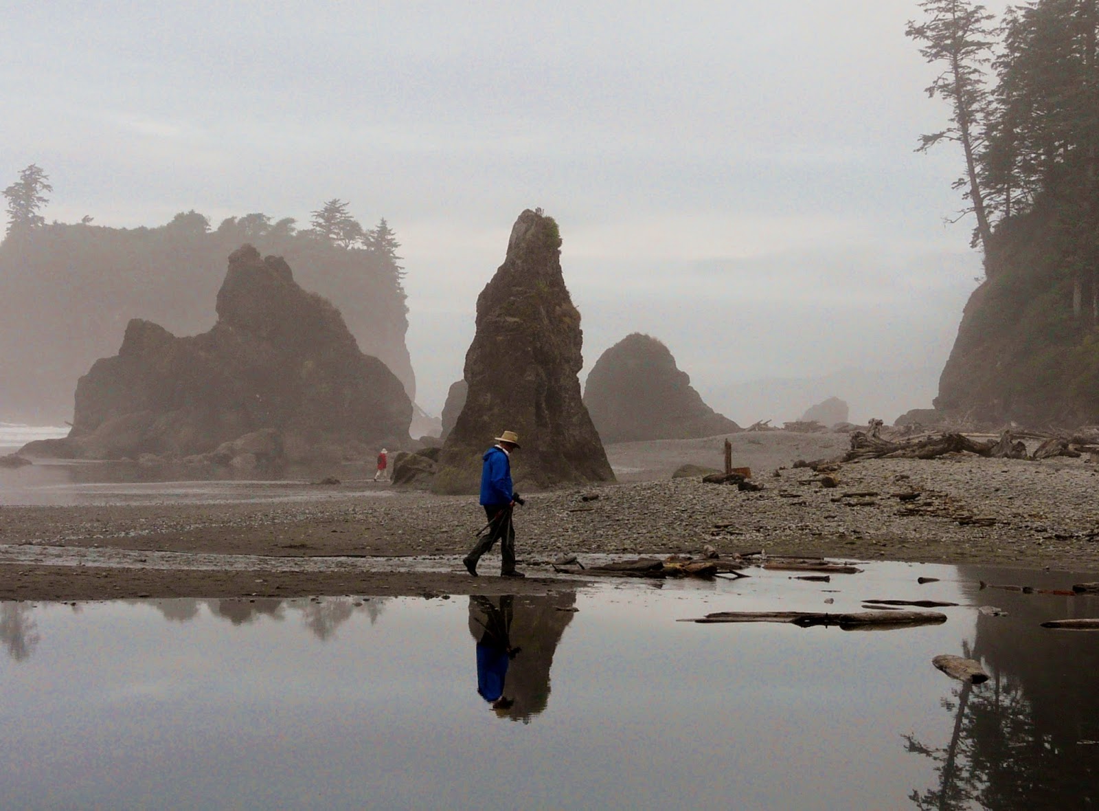
Ruby Beach on a cool, foggy morning
Advice:

1.  It's Cold - Don't expect Santa Monica sunbathing.  Even in August, these beaches are cool, cloudy, and have freezing water.  It's part of what makes them unique and home to abundant wildlife.  Enjoy the beach as a place to walk, explore, and photograph, but leave your beach towel and bikini at home.

2.  Check the Tide - Check a local tide chart.  It's best to explore the coast at low tide when you can poke around the pools and walk more of the beach.  

3.  Go Early to Avoid Crowds - None of these beaches will reach SoCal type crowding, but after noon, expect to see families and tourists exploring the beach. For a pristine, empty beach, get there early...or better yet, camp out on the beach!


My adventures - Three Olympic National Park Beaches and how to get there...

2nd Beach - La Push, WA

It's unfortunate this gorgeous shoreline has the un-romantic name of "2nd Beach".  It doesn't do it justice.
Little Girl finds Sea Star home
While 1st beach can get crowded due to it's easy street access, and 3rd beach is the the first crowded parking lot from La Push Road, 2nd Beach is tucked away between it's sisters.  It's the perfect escape.  After a short, wooded hike through giant, ancient trees, I emerged onto a open (and empty) one-mile stretch of beach.  Sea stacks and small rock islands pierced through a sea of fog, and as I walked, the wave of cloud would move, revealing and hiding new rock monoliths.  This was a great spot to explore tide pools.  I was relieved to see groups of healthy sea stars - not yet struck by starfish wasting disease.  It was exactly why I had wanted to visit this park.  It felt magical. 

Get there:  We drove 2 miles north on Rt. 101 to Rt. 110.  Turn left (West) on Rt. 110.  This will turn into La Push Road.  Travel about 13 miles on 110/La Push road.  You will pass the parking lot for 3rd Beach and the Quileute Tribal Office before coming to the parking lot for 2nd Beach.  

2nd Beach, La Push

2nd Beach, La Push


On the jetty at First Beach
1st Beach - La Push, WA

This is one of the easiest beaches to access in the park - No Hiking Required.  This beach sports a long jetty covered in large and battered driftwood.  I climbed on the largest piece of driftwood I've ever seen - a uprooted and weathered tree that had a root system still standing at least 25 feet high!  Rocky islands and needles rise offshore and create a unique coastal landscape.  I visited this beach to watch the sunset and even though it was foggy, it was amazing to watch colored sky peek through the cracks in the clouds.  

Get there:  We drove 2 miles north on Rt. 101 to Rt. 110.  Turn left (West) on Rt. 110.  This will turn into La Push Road.  Take 110/La Push Road to the end and you will enter the town of La Push.  Follow signs to 1st beach parking.


Ruby Beach - Olympic National Park

We were fortunate to reach Ruby Beach at low tide where I could get a hands-on experience with
Rock Needles at Ruby Beach
the many tide pools.  Large green anemones carpeted the rocks, rough blue mussels clung to the stone, and hand-sized orange and purple sea stars cooled in the pools.  We enjoyed the morning fog and many rock needles rising out of the sand while we wandered.  Our 9 am walk left us one of the only people enjoying this heavenly piece of nature.  It was the perfect way to end our trip in the park.

Get there:  From Forks, take Rt 101 south 27 miles to Ruby Beach parking area (there is a sign on the right).  Walk a quarter mile trail to the beach below.  

Although I loved every part of the park we explored, the beaches were my favorite.  The rock islets, foggy days, and enormous tide pool organisms create a place of wonder and peace.  It calms my soul and makes me yearn to return.  


Sea Stars in Olympic National Park

Ruby Beach

You might also enjoy...


Please leave comments and questions below...


Tuesday, August 19, 2014

Four Family Friendly Days in Olympic National Park

View from the top of Hurricane Hill near Hurricane Ridge in Olympic National Park
Although I was born and raised in Oregon, I haven't been to the Olympic Peninsula since I was very small. So, when I was out in Portland for a week this summer, I asked Mom if we could get out of town and head north!  She and my dad are travel writers and well acquainted with the sights of Washington.  They planned a wonderful, beautiful, and tranquil four days in Olympic National Park.  Our itinerary is perfect for someone looking for a smattering of what the park has to offer including easy-moderate day hikes and a little bit of everything - beaches, rainforests, and mountains.

Here's how to recreate this adventure....

Day 1 - Hurricane Ridge

Hurricane Hill hike
Activities:   Hurricane Ridge is in the Northern portion of the park.  It is easily accessible from the town of Port Angeles.  We started at the visitor center.  This alone provides magnificent views of snow-capped peaks (in August) and rolling hills of alpine gardens.  We spotted multiple deer on our drive (so watch out!)  Many hikes are accessible from this spot, but we chose to drive up the beyond the visitor center and take the "Hurricane Hill" hike.  This easy, paved trail winds 1.5 miles to the 5,757 foot summit with views of the surrounding mountains, wildflowers, bay, and even a peak at Vancouver Island.  After our hike, we enjoyed a picnic lunch in the car before returning to Port Angeles.
Hiking Hurricane Hill

Night Accommodations:  Port Angeles has a number of hotels, motels, and inns.  In addition, the Heart O' the Hills campground is located at the based on the Hurricane Ridge park gates and offers quiet, wooded spots to campers.

Food:  For dinner, we enjoyed a wonderful seafood dinner at Kokopelli Grill in Port Angeles (try the salmon chowder!)  Make reservations because it's a popular spot.
We also had a fantastic breakfast at the First Street Haven Diner.  Great cinnamon roll!


Day 2 - Lake Crescent, Maymere Falls, and Twilight
Lake Crescent


Activities:  On Day 2, we enjoyed breakfast at the First Street Haven Diner before heading out toward the town of Forks.  Along the way, we made a few stops to get a glimpse Washington State magic.  A favorite was the stop at the Lake Crescent Lodge.  This beautiful and charming inn is located on the still shores of beautiful Lake Crescent.  The day we visited, the lake was still - fog drifted through the surrounding hills, making it a serene and peaceful spot.  From here, we were able to take a hike to Maymere Falls.  This easy 1.8 mile round trip hike takes you to a narrow cascading falls nestled between old growth Sitka spruce.

Marymere Falls
We also made as stop at Sol Duc Falls (Also spelled Soleduck) located near the well-visited Sol Duc Hot
Springs (fee to soak).  Sol Duc Falls has multiple entrance points and trails to it, but we took the most trodden route from the parking lot located at the dead end road.  This 2 mile out-and-back easy trek takes you through beautiful forests, past a haunting hiker shelter to the bridge that overlooks the three falls.

From Sol Duc, we continued to the town of Forks. This town has become famous in recent years as the setting for the popular Twilight novels.   Before retiring for the night, I insisted on seeing some of the Twilight tourist attractions, such as ... the Forks High School (with original movie sign), a replica of Bella's truck at the town visitor center, and Forks Outfitters - where Bella worked.


Sol Duc Falls
Night Accommodations:  Forks has a few hotels/motels as well as camping available at Sol Duc and nearby LaPush.  We enjoyed our stay at the Forks Motel - where we were able to get a "suite" complete with two bed rooms, bathroom, and outfitted full kitchen.  This made us able to shop for groceries in town and make our own meals.

Food:  Because Forks has such limited dining options, we purchased groceries and made all our food in our kitchen motel room at the Forks Motel.

Tide pools at 2nd Beach
Day 3 - Beaches and Rainforest

Activities:  Our second day in Forks started by making our breakfast in the motel and heading out to LaPush.  This Native-American Land and town are home to some of the most amazing beaches I've ever seen.  After consulting a guide book, we decided to explore the "Second Beach".  A short, one mile walk through the Quileute Indian Reservation and we emerged on a stunning beach pierced by large rock monoliths.  As the fog cleared, more rock giants rose from sea.  Walking along the coast for 2 miles, we explored local tide pools and gazed at the evergreen-coated cliffs.  It was spectacular.


Moss covered trees in Hoh rainforest
After our walk, we returned to the hotel for lunch, before heading back into the park.  This time, we drove to Hoh Rainforest.  We took the short but SWEET "Hall of Mosses" trail.  Although only 0.8 miles, this loop trail took over an hour due to the frequent photo stops.  I really felt as though I'd stepped back in time.

We returned to the Forks Motel, where we made dinner, but watched the clock, and around 8 pm, headed to "First Beach" in LaPush in the hopes of seeing the 8:30 pm sunset dip into the ocean.  This beach is accessed directly from the town of LaPush and no hiking is required.  I marveled at the rock islands out at sea while climbing over the driftwood-covered jetty.

Night Accommodations:  Forks Motel (see above)

Food:  Made our own in our kitchen at Forks Motel.

Massive Trees along the coast

Day 4 - One Last Beach Walk

Morning at Ruby Beach
Activities: Before heading back to Portland, we stopped along Route 101 at Ruby Beach.  Since we got there at around 9 am, we found ourselves ALONE on one of the most amazing beaches I've ever seen!  We walked the sandy shores for a mile, photographing and gaping at the immense rocks and pristine tide pools. By the time we got back to the parking lot around 11 am, the lot was full and many families were combing the beach.

We returned to Portland refreshed by the purity of the Olympic Peninsula nature scenes and already aching to return.  I highly recommend this National Park for lovers of nature, mountains, waterfalls, and beaches.  It was the perfect way to enjoy a week in the Pacific Northwest!
Morning stroll at Ruby Beach

Additional Recommendations....

Sunset at 1st Beach in LaPush
- It's waaaaaaaaaaaay cooler  (like 20 degrees) in the Olympic Peninsula than in Seattle/Portland.  I packed shorts for a mid-August summer day, but instead spent the entire time in my one pair of pants and borrowed sweatshirt.  80 in the city could be 60 in the park!

- The peninsula has poor cell phone reception.  Even Forks, a populated town had me stuck on AT&T's "extended network".  The Forks Motel offered weak complimentary wifi - just enough to check email, but not much more.  Plan accordingly.

- Get to beaches early.  Although this park did not seem very crowded for a warm August weekend, we discovered that even getting to beaches at 9 am would give us the gift of solitude.

Bella's truck from Twilight in Forks, WA