Showing posts with label Crawford Notch. Show all posts

Saturday, January 2, 2021

Mt Avalon in Winter

With my Christmas vacation week, I was looking for a couple great White Mountain hikes to explore.  One of the ones I tried was going back to South and Middle Moat Mountain.  I've done it over and over, but it's only about an hour from my house and has amazing 360 degree views.  The other one was to revisit another awesome peak - Mt Avalon!

Mount Avalon in Winter

Choosing the Peak


I chose Mt Avalon for a few reasons.  My original plan was to do a 6-8 mile day.  I love that by taking the Avalon trail, you can easily hit up three peaks in about 7 miles: Mt Avalon, Mt Field, and Mt Tom.  This provides a lot of bang for your buck and hikers get gorgeous Crawford Notch views.  The last two times I've hiked this trail, I've been hit with snowstorms and haven't gotten to see it, so I was hoping this year would be different.

Sometimes you have to abandon the plan


I was wrong ... hiking up to Mt Avalon was slower than expected.  We hit two sizeable stream crossings as well as a trail that was literally a river of ice.  Halfway through our hike, high winds and wet snow made it a blustery white out on the summit.  The slow trek made us abandon our original plan to do three peaks and settled for a 3.4 mile out and back.  Even though it wasn't the hike we planned, it was pretty magical walking in the whites through a snow storm.

icy trail in the white mountains
Dexter did a better job navigating the icy trail than I did!

Here's how to recreate this adventure...

Adventure: Mount Avalon

Getting there:
Mount Avalon is accessible from the Avalon Trail located in Crawford Notch State Park.  The trailhead is easy to find.  Park at the Crawford Depot train station which is adjacent to the AMC Highland Center.  Cross the train tracks and follow the path to the trailhead which is well signed just down the path.
Snowy summit
Snowy Summit of Mount Avalon in the White Mountains

Trail:  
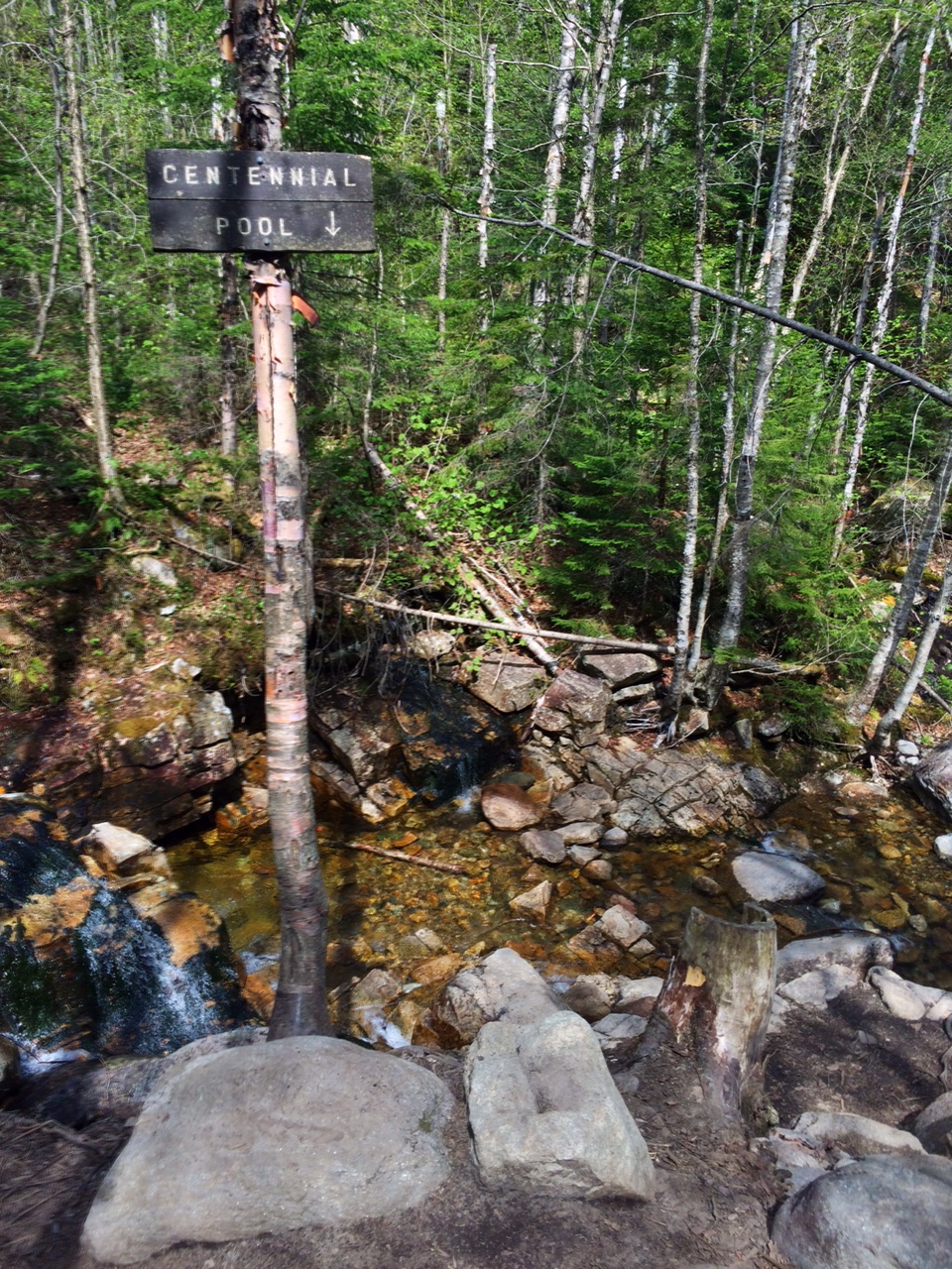
The hike to Mount Avalon is completely on the Avalon Trail.  About 0.1 miles from the train tracks, you will come to another large trail sign and the offshoot on the left to Mt Willard.  Continue straight on Avalon Trail.  The trail goes through beautiful hardwood forest and fairly soon has a water crossing.  On our hiking day, the water was high and wide, and we had to walk upstream to safely cross.  The stream was beautiful and had rolling cascades. 

After the stream crossing, the trail continues to climb and soon you will have to cross the stream again.  Due to high water, were forced to go up stream about 50 feet and cross and a narrower patch.  It was a beautiful brook - with more cascades. 

The trail reaches the junction for the A-Z trail.  Turn left to stay on the Avalon Trail.  It will start to climb and the forest transitions into more evergreen and boreal type forest. The trail got steeper (and icier) as we approached the summit. Eventually the trail levels out a bit as you approach the junction for the Mt Avalon summit.  Take the spur to the left and you'll reach Mt Avalon's summit.  There's not much room on the top - a small rock slab and a few trails to overlooks. 

Unfortunately, for the second time in a row, I got a snow storm at the summit and didn't get a view.  We turned around and returned the same way we came up.  For more hiking, you can pair this with other peaks in the Wiley Range.

Difficulty: Moderate to Hard

Distance: 3.4 miles out and back
cascades along avalon trail
Beautiful cascades along the Avalon trail

Recommendations:

- The Highland Center can be used for bathroom access and overnight accommodations. 

- For winter hiking, dress in multiple non-cotton warm layers, bring gloves, scarves, and hats.  Pack first aid, water, food, and extra clothing.

- In winter, you will need traction to do this hike.  Although there was little snow on the trail, I needed my microspikes for almost the entire hike.  Trekking poles were also really helpful for the descent over icy trail.

- This is a dog friendly trail.

- Parking at the Crawford Depot and Highland Center is charged in the high season hiking months but didn't seem to be charging when we went in December.

Skunked for a view again

Even though I didn't get to enjoy the Mt Avalon view again, I still enjoyed this hike and walking through the snow.  It just means, I'll get to revisit it again!

See more photos and adventure on my INSTAGRAM and FACEBOOK!

Mt Avalon in winter
Mount Avalon in Winter, White Mountains, NH

You might also enjoy these experiences:


Friday, January 10, 2020

Family Friendly Winter Hikes in the White Mountains

I am a monthly contributor to the website Seacoast Moms.  My writing for this site mainly focused on outdoor experiences for families of young children, however, my last two posts are useful for anyone thinking of starting to get into winter hiking!  

Artist Bluff in Winter, Franconia Notch
White Mountain Winter Hikes:

My recent post - Try a New Family Adventure: Winter Hiking in the White Mountains 
provides three great winter hike for anyone looking to see gorgeous views in a White Mountain winter. Check it out!
Me hiking Artist Bluff Trail in December 2019


Prepare with this Gear:
Also, if you haven't tried winter hiking before, check out my advice here  Although it's titled 

What You Need to Winter Hike with Baby - the footwear is critical for anyone taking that first step onto a snowy path.

Matt and son on a Crawford Notch trail - December 2019

Other Winter Hiking Posts:


Friday, June 17, 2016

Mt. Willard - Big Bang For Your Buck

I've mentioned Mt. Willard on this blog before.  It's definitely one of the best family hikes in the White Mountains.  This is because it's short, easy-to-moderate climbing, and has one of the most AMAZING views you will find in the area.  Don't let the easiness fool you...the view from the top rivals most of the famous 4,000-footers.  It had been years since I hiked this little mountain in Crawford Notch, but after giving birth weeks prior, I needed an easy peak for my first time back to the Whites postpartum ... and carrying a newborn.  My sister, Kelly, and I took off for an early summer hike- bringing along my baby son, Lucien, for his first White Mountain hike.

 Kelly stands at the summit of Mt.Willard with views of Crawford Notch.
Here's how to recreate this adventure...

Adventure:  Mt. Willard Hike

Getting there:  The Mt. Willard trailhead is located in Crawford Notch State Park.  From North Conway, take Rt 302 into the notch.  If coming from I-93, take exit 35 and follow Rt 3 North to Rt 302.

I usually park at the AMC Highland Center parking lot (to use the bathroom before heading out0, but you can get closer by using the Railroad Depot parking lot.

The trailhead is located just behind the depot (across the tracks).  Follow the trail for about 50 feet until you reach the official trailhead where you can choose between going straight to Mt. Avalon or turning left to Mt. Willard.

Crawford Notch Railroad Depot is a good place to park.

Centennial Pool
Trail:  This out-and-back trail starts with a stream crossing.  In summer, it's usually a fairly easy crossing, but I have experienced higher water (and wet feet) in the spring after snow melt.  The trail is an easy to moderate climb.  At 0.4 miles, you reach Centennial Pool - a little offshoot with a nice view of a small cascade and pool.  Continue 1.1 miles through hardwood forest.  Near the summit, the forest changes to short and crowded evergreens.

Final section of the trail
As the trail flattens out, you'll 'see the light' where the trail ends at a magnificent ledge looking down at Crawford Notch and Rt 302.  Although this is not a 360 degree view, it is by far one of the best in the area and definitely the best for such a short hike.  Pull out the map and try to identify all the peaks around you!  You can see multiple recognizable 4,000-footers - including Mt. Washington!

Difficulty: By White Mountain standards, this is an easy peak.  It is a great choice for everyone from families with small children to experienced hikers looking for an amazing view.  Be aware that there is a climb and that it involves a stream crossing.

Distance: 3.2 miles total (out-and-back)

Recommendations:

Summit View

- Although you can't see it, there is a popular rock-climbing route below the summit ledge.  DO NOT THROW ROCKS OR ITEMS OFF THE EDGE.

- Prepare for a stream crossing.  I use trekking poles to balance on the rocks to cross.

- Although it is a great family hike, adventurers should be prepared by bringing lots of water, snacks, rain/sun gear, and a first aid kit.  Anything can happen in the Whites.

- This is a very popular summer hike due to it's proximity to the Highland Center and its easiness.  Be prepared to interact with other hikers on the trail and summit.  Because of this, I didn't bring my dog Summit (although they are allowed).

Summit Selfie
- There are no bathrooms or water facilities at the trailhead, but you can get this (as well as advice, food, and lodging at the nearby AMC Highland Center.

- The summit/ledge is extremely dangerous.  Watch children and dogs carefully.


Although I'd hiked this trail many times, I still gasped at the view.  It is truly spectacular scene and a reminder why I love the White Mountains so much.  I can't think of a better hike to share with my infant son as his first "White Mountain Hike".


You Might Enjoy These Adventures As Well:

- 5 Best Family Hikes in the Whites

- Liebeskinds Loop, Lila's Ledge, and George's Gorge

- Welch-Dickey Loop


Saturday, September 26, 2015

Mt. Carrigain Loop - 4000 footer and more

View of Mt. Carrigain summit as you approach from Signal Ridge Trail

A perfect fall day was improved by a White Mountain hike with two of my favorite girls.  We started the adventure with a plan to summit the 4700 ft Mt. Carrigain as an out-and-back hike.  Once on the summit, the ideal weather made us long for more, so we continued down Desolation Trail to Carrigain Notch Trail - making a sweet 13.5 mile loop.  It was a great way to enjoy the mountains, views, and friends.

Adventure: Mt. Carrigain Loop

Trailhead across from parking lot.
Getting There: From southern New Hampshire, we took Highway 16 north to North Conway.  Here we took Rt 302 North/East towards Crawford Notch State Park.  Just after the town of Bartlett, take a left on Sawyer River Road (closed in winter).  The road is across from Fourth Iron Tentsite and if you enter Crawford Notch State Park, you've gone too far.  Drive up Sawyer River Rd about 2 miles.  A signed parking lot is on the left and the trail is on the right.  There are no bathrooms and no cell service at the trail head.


Trail:  The adventure starts with Signal Ridge Trail.  The trail parallels a brook and is relatively flat for the first couple miles.  It winds through beautiful hardwood forest.  At 1.7 miles, you reach the junction for Carrigain Notch Trail.  Stay left to summit.  As we continued, the trail rapidly changed to a steady uphill climb.  The hiking isn't difficult (no slab or boulders), but the constant up can be very tiring and strenuous.  From the junction, continue 3.3 miles until you reach the summit.  Hikers can climb the fire tower for a 360 degree of the Pemigewasset Wilderness.

Summit of Mt. Carrigain
After enjoying our lunch in the sun, we decided to continue our adventure by making our hike into a loop (adds 3.5 miles to the previously planned out-and-back).   Desolation Trail was a steep grade - narrow, mossy rocks made for a slow and cautious decent.  At 1.9 miles Desolation reaches Carrigain Notch Trail.

Continue along Carrigain Notch Trail over a relatively flat path.  We crossed streams and were surrounded by more hardwood forest.  There were few other hikers on the remote trail and we enjoyed the solitude and easy hiking.  After 4.1 miles on Carrigain Notch Trail, you meet back with Signal Ridge Trail.  Take the 1.7 flat trail back to the parking lot.   It was a wonderful long loop and I highly recommend it!


Difficulty: Moderate - Difficult.  The trails themselves aren't too bad (although Desolation had it's difficult moments), but the long trail and sustained hiking makes this day hike for experienced hikers only.

Descent on Desolation Trail
Distance:  13.5 miles for complete loop.  10 miles for an out-and-back to Mt. Carrigain.

Recommendations:  

- Even though half of this loop is on flat ground, two of us ran out of water on the last couple miles.  Bring over 2 liters when traveling over ten miles.

- There was no cell service at the parking lot or along the hike.  Make sure loved ones know where you have gone and when to expect you back.

- There are no water or bathroom facilities at the trailhead nor along the hike.  Plan ahead and be prepared.

- Sawyer River Road is closed in winter.  Be aware of road conditions if planning your hike for late fall - early spring.

Summit the Dog on Carrigain Notch Trail


I LOVED this hike with my friends Courtney and Ingrid.  I'm so grateful to have friends who share my love of nature and the great outdoors.  Consider this for your next big day hike!


Please leave comments and questions below.  Don't forget to visit us on Facebook at https://www.facebook.com/TheFreelanceAdventurer

Best of Friends on the Mt. Carrigain Fire Tower!

You might also enjoy...

Mt. Moosilauke - Moderate Hike for a Major View

Butt Burner in the White Mountains - Mt. Flume to Mt. Liberty

Mt. Pierce in Late Spring

Tuesday, October 1, 2013

5 Best Fall Foliage Hikes in the White Mountains

View from The Flume Gorge Hike.  Photo by Bruce Hansen
New Hampshire is well known for its beautiful scenery and stunning fall foliage.  Crimson and bronze leafs bring throngs of tourists to the Granite State.  Whether you're a Tough Mountain Climber or a Leisurely Nature Wanderer, this state has a foliage hike for you!  Here are the 5 best fall foliage hikes in the White Mountains for ANY ability level. 


Short and Easy

Flume Gorge Trail, Photo by Bruce Hansen
Flume Gorge, Franconia Notch State Park - This two mile loop leaves from the Flume Visitor Center on I-93 in Franconia Notch, New Hampshire.  The easy trail offers views of the narrow gorge, brooks, and White Mountain views.  The walk also takes you through two iconic covered bridges, and over the pristine Pemigewasset River.  Although it is an "easy" hike by White Mountain standards, there are uphill portions, including stairs.  Parking fills quickly on weekends, and visitors should be aware that there is a cost - $15 per adult and $12 a child.  Still, the price tag is worth the view you get on this iconic mountain trail. 


Elephant Head, Crawford Notch State Park - This short walk offers a quick (and slightly steep) uphill stroll to the top of Elephant Head.  I recommend parking at the AMC Highland Center, crossing Rt 302 on foot, and walking around Saco "Lake" Trail (0.3 mile) first.  This connects to the Elephant Head Spur (0.1 mile).  From the top of the "head",  you get a view down the scenic notch.  This is a perfect place for a picnic.  Be aware, rock climbers climb the face below, so don't throw rocks or object over the cliff. 

Medium and Moderate

Summit of South Moat Mountain
South Moat Mountain, Conway - This 5.4 mile out-and-back hike takes you across streams, through forests of birch and maple, and summits the 2,770 ft bare peak of South Moat Mountain.  Since you never rise into the 3,000 foot boreal zone, the views from the summit are pure foliage bliss.  What's more, the last mile offers many viewpoints, where you can easily see the colorful forest valley below and surrounding White Mountain peaks.  To access the trailhead, drive north on Washington Street from Conway Village then take a left on Passaconaway Rd.  This turns into Dugway Rd.  The parking lot and trailhead is on the right.  There is a parking fee of $3 per car at the trailhead by cash/check. 

Hedgehog Mountain, UNH Trail
Hedgehog Mountain, Kancamangus Highway - This 4.8 mile hike leaves from the Downes Brook Parking Lot Trail on the south side of the Kancamangus Highway (Rt. 112).  Parking is $3 per car, per day.  Take the Downes Brook Trail to the UNH Trail.  This trail through hardwood forest, up ledges, and by water, offers beautiful views of the Sandwich Range as well as prime foliage forest.  It's also a loop trail - hard to find in the Whites!  Hedgehog summit is at 2,532 feet and there are multiple views on ledges along the way. 

Challenging and Longer

White Mountain Woods in Fall
Webster Cliff Trail, Crawford Notch State Park - This trail is stunning and the
perfect place to get continuous views of the multicolored Crawford Notch.  The cliff trail can be accessed on Rt. 302, just across the Arethusa Falls trailhead.  The Webster Cliff Trail (AT) scrambles a mile to the cliff and traverses over a steep and rocky cliff for another 2 miles.  This provides uncomparable views of Crawford Notch and surrounding mountains.  Hikers summit Mt Webster (3910 ft) before reaching a cut-off back to the road.  I like to continue on the AT, hiking 1.3 miles to summit Mt. Jackson (4052 ft), before dropping back to 302 on the Webster-Jackson Trail.  Hikers then have to decide if they are going return back the way they came or continue on the 2.5 miles to the AMC Highland Center where you'll need to get a ride back to your car.  As a straight hike from the trailhead to the Highland Center, it is 6.9 miles, but is much more when hiking out and back. 

For more information on fall hiking, check out former fall posts:

Fabulous Fall Foliage Family Friendly Hikes

Top Ten Things To Pack For a Fall Hike


Fall is a great time to avoid some of the 4,000 footers that take you into the evergreen-populated "boreal" zone and stick to some of the colorful lower peaks where maples, birch, and beech leaves are red, yellow, and orange. Please leave comments and questions below....

Franconia - Flume Gorge Trail