Showing posts with label half day. Show all posts

Monday, June 22, 2020

Bald Peak - Mountain View at less than 3,000 feet

Last week, after visiting Sugar Hill to see the lupines, my friend Kaley and I decided to tackle a hike in the area before heading back to the Seacoast.  Bald Peak came up in my All Trails search as being in the area, having a view, and being a moderate climb.  The 4.5 mile out-and-back trail was lightly trafficked on a June Tuesday afternoon and all I hoped for - moderate climb and amazing summit views all to ourselves.  

Enjoying a view with dog on Bald Peak, White Mountains


Here's how to recreate this adventure...

Adventure: Mt. Kinsman Trail to Bald Peak

Getting there: The Mt. Kinsman trailhead is located just north of Franconia Notch State park in Franconia, NH.  To get there from the Seacoast or Massachusetts, take I-93 North through Franconia Notch.  Take exit 34 C onto NH-18  North toward Echo Lake.  Follow NH-18 north 6 miles and turn left onto Kerr Rd which turns into Wells Rd. After 2 miles, turn left onto NH-116 South.  The trailhead is 2 miles down this road on the left. There is a small parking lot.  There is no fee box or bathrooms.  It is two hours from my home in Rochester/Dover area.

Waterfall on Mt Kinsman Trail
Waterfall along Mt Kinsman Trail

Trail: 
The trail is mostly a steady uphill climb.  Although strenuous to constantly climb up, there is no technical slab, rocks, or slides on this hike.  We slowly climbed through hardwood forest, passing what I assume is some sort of maple shack in the first quarter mile.  The last mile or so we were rewarded with some small stream crossings including some beautiful cascades and a small waterfall.  Water was low and it was easy to cross.  
    The last quarter mile we reached the junction for the Bald Peak spur.  Turn right and follow the spur trail that brings you to the open peak.  The "summit" rewards you with a gorgeous 270 degree view of the Kinsmans and northern Franconia Notch.  There's a large open rock slab with a boulder sitting in the middle. We loved sitting in the sun and enjoying the view.  Kaley even said she thinks it's more impressive than Mt Willard (I disagree).  To return to the car, go back the same way you came up.  It is an out-and-back trail.

Difficulty: Moderate.  The steady uphill climb can make you really huff and puff and small brook crossings can be somewhat challenging but there's no technical hiking/climbing skills needed.

Bald Peak Spur Trail
Distance: 4.5 miles total 

Recommendations: 

- There are no bathroom facilities available at the trail head. 

- Parking is free.

- Hike this in June and pair it with a trip to see the Sugar Hill lupines!

- This is a dog friendly hike.  Please be considerate to hikers and leash your dog when approaching others.


Panorama of summit of bald peak
Panorama of summit of Bald Peak

A Perfect Day

Combine wildflower viewing with a White Mountain hike and stellar views made for a perfect day in the Whites.  Perhaps I will have to recreate this next June!

You might also enjoy these similar adventures...


View of Mount Kinsman from Bald Peak in the White Mountains
View of Mount Kinsman from Bald Peak

Friday, March 6, 2020

White Ledge Loop in Winter: Moderate White Mountain Hike with a View

It's hard to get much better than this.  White Ledge loop trail is one of my go-to hikes.  Last weekend I finally hiked it in winter, and like every other season - it was perfect. This 4 mile hike has everything you need for a convenient and worthwhile trek: shorter drive, loop trail, moderate/dog friendly trail, and mountain views.  I've enjoyed this trail in every season.

White Ledge Loop Summit in Winter, White Mountains, NH

Here's how to recreate this adventure...

Adventure: White Ledge Trail in Winter
Trail Sign at Junction for loop.
Getting there: The trail is accessed from the White Ledge Campground on Hwy 16 in Albany, New Hampshire.  It is only 5 miles south of Conway, NH.  In winter, the campground entrance is blocked and not plowed.  We parked on the side of the highway, not ideal, but there aren't many options.  We saw another hiker park in the business lot across the highway, then walk across but I'm not sure if that's technically "allowed".  I love that this trail is only one hour from my home in Rochester. In camp-season months, hikers park just inside the campground entrance on the right and there is a WMNF fee associated with parking (currently $5). 

Trail: Walk straight through the campground entrance to the clearly marked trailhead sign at the back of the campground.

The trail starts straight and flat. There is a small stream crossing in the first quarter mile.  Follow the yellow blazes for 0.3 miles until you reach the trail junction and start of the loop.  I have only ever gone counterclockwise.  This choice will lead to a longer and more gradual incline and your descent steep and shorter. 

The first third of the hike is a gradual incline through hardwood forest with the shadow of White Ledge summit on your left.  Be careful to stay on the trail.  In winter, we discovered it was easy to lose your way as there were no fresh tracks or path to follow.  The trail will take a left turn and start to increase steepness as you climb up the ledge.  In winter, footing with traction was easy as all the rocks and slab were covered in snow.  Around 2 miles, the blazes turned to cairns and for a couple minutes we had trouble finding the buried rocks.  Eventually we found the trail and continued up to the ledges.  As you climb, look behind you!  We were gifted with gorgeous clear views! 

At about 2.5 miles, you will reach the official summit - a partially clear view on your left of southern Whites.  Past the peak, you continue on the loop and get some excellent views of Mt Chocorua on your right.  There are a few steep parts on the early descent but nothing I'd label as difficult by White Mountain standards.  MicroSpikes and trekking poles helped keep our footing.

Winter proved to be another great season to hike White Ledge loop trail.  As usual, even on a gorgeous weekend, we only saw one other hiking pair here.  This is the perfect hike for someone looking for a sweet solitude hike with some great views.
Keep an eye out for Blazes.  It's easy to lose the trail.
Difficulty: Moderate

Distance: 4.1 mile loop plus extra walking through the campground to road.
Winter afternoon light.  Can you see the trail?  Look for blazes!
Recommendations: 

- Trail can be icy or snowy in winter.  I recommend preparing with traction.  I personally prefer using MicroSpikes and trekking poles to keep my footing but saw the other hikers with snowshoes. 

- If hiking in winter, you'll have to park on the side of the highway.  There is no access to bathrooms and no parking fee required. The campground is open late May - labor day weekend.  During these months, park inside the gate and expect to pay at the self service area.

- Dogs are allowed on the trail. 

- Careful to stay on the trail.  The yellow blazes are easy to lose and the trail is not well worn.  Use an AMC White Mountains Trail Map #3 to find location and trail information.

View of Mount Chocorua from White Ledge Loop Trail.
You might also enjoy these similar experiences:

- South Moat Mountain in Winter

- Boulder Loop Trail

- Liebeskinds Loop in Winter

Wednesday, May 17, 2017

Boulder Loop Trail - A Perfect Family Hike in the Whites

Fall View from Overlook on Boulder Loop Trail, White Mountains, NH

Now that I have a little one, I find myself trading out some of my 4000-footer hikes for shorter, less strenuous climbs.  My one-year-old son has been "hiking" since he was a week old, but understandably, after a few hours on the trail, he gets restless. As a result, I've tried hikes that are less than 5 miles with little to no technical climbing involved.  Most of the hikes have already been written about on this blog such as: Mount Major in Alton, White Ledge in Albany, Blue Job in Farmington, and Mount Willard in Crawford Notch.  I was searching my blog to see if there are any I should add and I realized I had not written about one of my favorite family-friendly loop hikes in the Whites - Boulder Loop off the Kancamagus Highway!

This 3 mile easy-to-moderately difficulty hike is perfect for a taste of the Whites.  It provides excellent views, moderate strain, and is easily accessible with a parking lot and bathrooms near the Covered Bridge Campground.  I especially enjoyed it this fall when I took my parents who were visiting from Oregon to see the fall foliage.

Here's how to recreate this adventure:
Trail Sign

Adventure: Boulder Loop Trail in Albany, New Hampshire

Getting there:  The trailhead is easily accessible just off the Kancamagus Highway.  From Conway, New Hampshire, take the Kancamagus Highway (Rt 112) about 6 miles to Dugaway Rd on the right.  You should see signs for Covered Bridge Campground.

There are two parking options.  In the off season (winter and early spring), I park in the parking lot on the right before the bridge.  Then walk across the bridge and follow signs to the trailhead.  In summer and fall, you can cross the covered bridge and park in the Boulder Loop parking area on the right of the road.  The trailhead is across this road from the parking lot.  Since it is National Forest, you need to pay a parking fee (cash or check) at the kiosk or have a WMNF parking permit.

Boulder Loop Trail
Trail: The trail is well signed.  Start by going 0.2 miles to the loop.  You can go either clockwise or counter clockwise (I always go counter but I'm not sure why).  If you go counter-clockwise (to the right), there is 1.3 miles of gradual uphill ascent.  It is continuous but not strenuous.  About half way up the trail veers left and has a steeper ascent (still moderate) until you get to a spur trail (marked) for the outlook.  Take the 0.1 mile spur to a series of viewpoints and ledges.  In fall, these views are spectacular.  Nestled in the hardwood zone, you get a superb view of the foliage.  

I usually enjoy a break or snack at the ledges before heading back to the loop.  Continuing on, the trail descends at a moderate difficulty, weaving a little back and forth for 1.1 miles before reaching the spur trail again.  

Difficulty: Easy to Moderate - By White Mountain standards this trail is on the easier side, however, it does involve some large boulder steps.  To preserve my knees, I always bring trekking poles on White Mountain hikes since it's a guarantee that it will be rocky and in some places steep.  It's shorter length makes it a great option for families or anyone wanting a shorter peak but still great views.  

Distance: About 2.8 - 3.5 miles depending how far you explore the spur trail/overlook.
Beautiful Fall Leaves

Recommendations:

- This is on White Mountain National Forest Land so you need to pay a cash or check fee in the parking lot.  Don't forget your money - exact change ($3 when written).

- There are privey bathroom facilities available near the trailhead.

- This hike is very popular in the summer and can get crowded.  Consider trying it in early spring, winter, or fall!

- Dogs are allowed on leash.

- Careful at the overlook ledges - there are steep dropoffs.  Watch children and pets.  Do not throw rocks or items over the edge as their could be rock climbers below.


I enjoy Boulder Loop Trail with my mom and son
I've enjoyed this hike at least twice this year and will probably visit it again this summer.  It's long enough to be worth the drive, but short enough that my little one won't be too bored in the pack.  Happy hiking!


Tuesday, June 28, 2016

White Ledge Trail - Solitude and Views near North Conway

Views from White Ledge Trail
My quest continues to try new hikes in the Whites.  Now that I'm carrying a baby as well as a pack, I need to be a little more strategic about where I hike.  Since carrying a baby on your front limits visibility and stability, I've been picking out trails that have relatively easy footwork but still have amazing views.  So far I've taken baby Lucien up Mt. Major, Mt. Willard, and Mt. Kerasarge North (as well as multiple shorter nature walks).  All these peaks had great views and I was able to tackle it easily with the added weight and constraints of a newborn on my chest and a backpack on my back.

Slab portion near summit of White Ledge
Scouring my AMC White Mountain maps, I stumbled upon a 4.1 mile loop hike just off Highway 16 south of Conway.  After reading the trail description, I decided it was worth a try.  White Ledge Trail did not disappoint!  It was a great hike- a good combination of flat, hills, and slab hiking.  The views of the lower White Mountain range and neighboring lakes was stunning.  What's also surprising was that for such a family-friendly hike, on a nice summer day, we only ran into one other hiker.  Gretchen (a local from Albany) informed us that the hike is never crowded- a gem in the Whites!  It was a great way to spend the day with my son and mom.

Here's how to recreate this adventure...


Adventure: White Ledge Trail Loop

Getting there: White Ledge Trail is located in the White Ledge Campground off Highway 16
Trail sign at back of campground. Park at front where marked.
in Albany which is about 15-20 minutes south of North Conway.  Unfortunately, the campground sign had been removed or broken when we came (June 2016), but fortunately I had a map.  Coming from the south, the campground is past the Piper Trail on the left.  Once in the campground, pass the campground pay station (apparently day use does not need to pay) and park on the right where it says 'Day use and Picnic Parking'.  There is an outhouse and picnic area.  To access the trail, walk up the campground loop.  The trail is located 'in the back' of the campground before the the road loops around.  There will be a sign marking the trail.


Mom enjoys White Ledge Views.
Trail:  The trail begins by walking through some hardwood forest.  The trail here is easy with a small stream crossing.  Follow the yellow blazes for 0.3 miles until you reach the trail junction for the loop.  We decided to take a right and do the trail counter clockwise.  If you go this way, you will reach the best views at the last mile of the hike.  The loop part itself is 3.5 miles.  The first part was relatively flat.  There was a little elevation gain here and there and then the trail would level out.  I could tell it was not frequently traveled as a few times, I grew concerned we had lost the trail.  Be careful and watch for the blazes!  Around 2 miles, the trail increases elevation and includes some slabby climbing.  Blazes turn to carens as you get out of the trees and onto rock.  Nice views start to appear behind you and various ledge poke out with glimpses of the surrounding forest and mountains.

Around 2.5 miles (traveling counter clockwise) you will reach the summit.  Someone has spray
Spur Trail on the way down has gorgeous view!
painted "VIEW" onto the trail with an arrow so it's tricky to miss.  We enjoyed our lunch on the summit before taking the the rest of the loop down.  Our one hiker encounter, Gretchen, gave a tip that past the summit about 15 minutes, a spur trail on the left will take you to a great view of the glacier-scraped lakes below.  It was a great tip and a beautiful view.  We returned to the fork and then hiked out the 0.3 miles to the campground.  It was a beautiful easy-moderate hike.  It would be great with families or just someone seeking solitude and an awesome view.  I can't wait to go back!


Difficulty:  Easy-Moderate.  There is no difficult footwork (by White Mountain standards), but the mileage makes this a moderate hike since it takes 3-4 hours.

Recommendations:

- Use your AMC White Mountains Trail Map 3 to find the location of the hike.  When we visited
(June 2016), the White Ledge Campground Sign had been removed off Rt. 16.

- Although the hike is relatively easy, weather and conditions can change rapidly in the White Mountains.  Bring plenty of water (at least 1 L a person), snacks, map, rain gear, and a first aid kit.

- Watch carefully for the Yellow Blazes.  The trial is not very worn and it's easy to mistake a deer trail or spur trail for the actual trail.  At one point, my mom and I retraced our steps backwards to make sure we were still on the trail.

- There are pit toilets available at the trailhead.  From what I could tell, it did not cost anything to park as a day visitor.

My mom, baby Lucien, and I really enjoyed this quiet and enjoyable hike.  It was a treat to find solitude in the woods and experience a new view.
Lucien and I enjoy the view

You might also enjoy these hikes...

- Mt. Major is a Major Treat!

- Liebskinds Loop in Pinkham Notch

- Welch Dickey Loop

Selfie on Summit of White Ledge

Saturday, November 7, 2015

Welch-Dickey Loop - Amazing Views in the Heart of the White Mountains

View of Mt. Welch from Mt. Dickey on Welch-Dickey loop
I've been wanting to do this hike for a long time.  I mean - this is one of the most popular hikes in the White Mountains - and I'd never tried it!  So when my friend Sarah suggested we take the dogs for a late fall hike on the Welch-Dickey loop, I jumped at the chance.  It is easy to see why this trail is so popular - the 4.5 mile hike is a true loop that includes amazing mountain views without the need to go to 4,000 ft (the peaks are in the mid - 2000ft).  Late fall was a great time because the crowds were low and the weather still mild enough that we didn't need traction on our boots.  Here's how to recreate this adventure...

Adventure:  Welch-Dickey Mountain Loop
Leaf-covered trail in November

Getting there:  The trailhead is located off I-93 near the town of Waterville Valley.  To get there, I took I-93 North to exit 28.  Drive East on Rt 49 toward Waterville Valley.  Turn left onto Mad River Road then turn right onto Upper Mad River Road.  Follow the "hiking" sign and turn left onto Orris Road.  The parking lot with be on the right with a well marked sign.

Trail:  The trailhead is at the end of the parking lot.  This is a true loop.  Just walk 0.1 mile down the trail and you'll come to the fork.  We decided to do a counter-clockwise loop by taking the right fork first.  This appeared to be the more popular direction, but hikers could enjoy either way with equal challenge-level.
     We followed the yellow blazes up a gradual and moderate climb.  Soon we popped-out onto a ledge and viewpoint.  I could see the Sandwich Range to the south and behind us, the summits of Welch and Dickey. We continued up granite slab, all-the-while enjoying the views.  We were lucky to hike the trail on a dry day, but I imagine this trail could be very dangerous if it was wet or icy.  From the summit of Mt. Dickey, we descended down a slab ridge.  This is your last time above the trees.  We enjoyed a snack and staring at the loop hike that we had almost completed.  Continue down the trail and in no time at all, you'll be back at the parking lot.
      The dogs handled this trail with no problems at all and we came across many other dogs on the trail.

Be prepared to walk up slab near the summit of both peaks.
Difficulty:  Moderate-  This trail starts out easy and turns to a moderate slab climb near the summits.  That said, if it's wet or icy, this trail could quickly become dangerous above treeline.  The granite slab is great for open views, but hikers should be careful when climbing.

Enjoying the view of Mt. Dickey from Mt. Welch
Distance: 4.5 mile loop

Recommendations:

- Get there early!  Even in November, the parking lot and trail is very popular. At 9 am the parking lot was mostly full.

- You will need a National Park/Forest parking pass or $3 per vehicle to park in the lot. Bring exact cash or check.  There are envelopes to deposit your money in near the trailhead sign.

- There are pit toilets at the parking lot.

- There is no cell service in the lot.  Plan accordingly.
Final ridge walk down from Mt. Dickey

- Remember that the Whites have their own weather.  It might be 70 and sunny in Boston, but icy trail conditions up north.  For late fall hikes, bring microspikes or other traction options just in case.  A warm coat, gloves, and hat are a must.

I loved this moderate loop.  It would be wonderful to try it in every season.  I can see why it's a favorite for hikers in the area.

You Might Enjoy These Hikes As Well...

5 Best Family Hikes in the White Mountains

Lonesome Lake - Perfect Family Hike

5 Best Fall Foliage Hikes in the White Mountains

Summit gets some love!

Please leave comments and questions below.

Monday, August 3, 2015

Lonesome Lake - The Perfect Family Hike

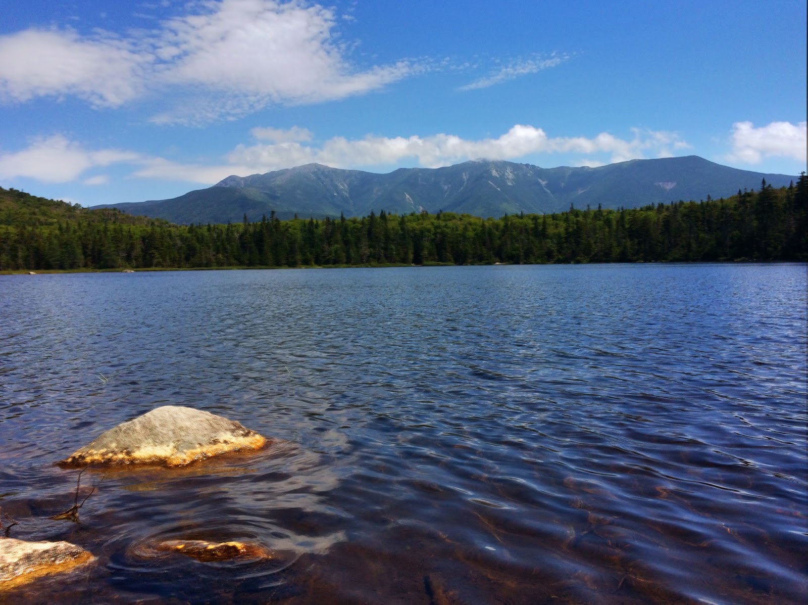
View of Cannon Mountain from Lonesome Lake

Lonesome Lake is a perfect hike for kids!
There are a million hikes to choose in the White Mountains - long, short, steep, flat, wet, dry - the list goes on and on.  But if you are planning a hike for a three-year-old, you need to choose wisely.  In my most popular post "5 Best Family Hikes in the White Mountains", I suggest this jaunt up Lonesome Lake Trail to mountain views, bog-bridge trails through meadows, and a comfy lunch spot at the AMC Hut.  It was time to put it to the test. On this perfect summer day, my friend Ingrid and I took her two kiddies - one-year-old Georgie and a three-year-old Ilsa to this iconic spot in New Hampshire's Franconia Notch.  Read below to replicate our adventure...

Adventure: Day Hike to Lonesome Lake

Ilsa crosses a small brook near the campground.
(Photo by Ingrid)
Getting There:  The trail-head for Lonesome Lake is located in the popular Lafayette Campground in Franconia State Park.  The campground is only accessible from a southbound exit on I-93.  If you are coming from the south (like I was), pass the area and take the Cannon Mountain exit, where you can get back on I-93 South.  The parking lot fills quickly on weekends, so plan to get there early.  If you can't, you can park on the I-93 north side at the Falling Waters Trail and take the under-highway tunnel to the campground.

Trail: From Lafayette Campground, take the Lonesome Lake Trail (yellow blaze).  After about 0.4 miles, the trail reaches a junction with the Hi-Cannon Trail.  Continue on Lonesome Lake Trail through hardwood forest.  The trail is uphill but moderate - giving hikers stone steps to help them up steep sections and even a few switchbacks (unusual in the Whites!)  Continue another 0.8 miles (1.2 total now) to the east side of Lonesome Lake.  Take a left and travel Around Lonesome Lake Trail- getting glimpses (and sounds) of the lake and shore.  After about 0.4 miles, you will pass over a bridge that gives clear views of Cannon Mountain mirroring on the clear lake before reaching the platform/beach area and the stairs to the hut.
Ilsa enjoys a swim at Lonesome Lake (photo by Ingrid)
In the summer months, the beach area is a perfect spot to rest or swim in the summer time.  On a hot weekend day, plan on sharing the area with 10-20 people who share your love of nature.  From the swimming area, visitors can get a clear view of Franconia Ridge in the distance.

Bog Bridges Around Lonesome Lake Trail.

Don't forget to visit the hut for a cookie or cup of hot chocolate (and possible bathroom break) before continuing around the lake.  From the swimming area and hut, continue on the Around Lonesome Lake Trail another 0.4 miles onto a path of bog bridges that travels over fragile meadow and wetlands.  Sneak a peak in the small streams and you might see some small trout swimming in the shallows!  As Ilsa informed us, "It looks like a fairyland!"

Soon, you'll return to the junction with Lonesome Lake Trail.  Return the way you came.  If you are a lucky little girl, you might have your Auntie Lindsey carry you down so you can rest your little legs.  Back at the campground, use the restroom before returning to the car for the ride home.

Difficulty: Easy to Moderate

Distance: 4.2 miles round trip including doing the perimeter of the lake.

Recommendations:
Summit gets a swim in too!

- Set up your children for success.  Get them excited about their hike - tell them what they might see, what the trail will be like, etc.  Bring trail snacks, treats, a toy, and a change of clothes and towel (for swimming).

- Young children should not carry a backpack (unless they ask to).  Make the experience lighthearted and fun.  Give positive affirmations for good hiking behavior.

- Bring a back up carrier for little kids.  Our three-year-old hiker rocked the hike up (with a couple candy bribes and many stops), but was pooped for the downhill.  We were prepared with a backpack child carrier.

- Take advantage of the hut bathrooms and rooms to allow children to comfortably change clothing.  You can also refill potable water here.

- There is no charge for parking.

- Get to the parking lot early on summer weekends.  It fills quickly!

- Check the weather - the White Mountains are prone to afternoon thunderstorms and variable weather.  Plan ahead and be prepared!
Kids hang out at base of AMC hut.
(Photo by Ingrid)

It was a PERFECT day in the White Mountains -  clear, sunny, warm (but not hot), and not humid.  We all enjoyed our hike up the shaded trails of Lonesome Lake Trail to the sunny swimming beach at the hut shore.  If you are looking for a great kid-friendly hike or just a moderate hike of your own, you won't regret spending your day in Franconia Notch's Lonesome Lake.

You might also enjoy the following posts:
-  Sugarloafs - 2000 footers with Outstanding Views
-  Best Family Hikes in White Mountains, NH
Livermore Trail - Easy Multi-use trail in the White Mountains

Please leave any questions and comments below.  Don't forget to like The Freelance Adventurer on Facebook and on Instagram @FreelanceAdventurer.

View of Franconia Ridge from west side of lake.

Sunday, May 24, 2015

Livermore Trail - Easy Multi-use trail in the White Mountains

Stopping along the Livermore Trail in Waterville Valley
Sign off of Tripoli Rd directs you to trailhead
A couple weeks ago, Summit and I headed up to the Waterville Valley area to tackle Mt. Osceola - a popular 4,000 footer in the White Mountains range.  Unfortunately, when I got there, I discovered that although it was May 9th, the access road was still closed for "winter".  Hiking the road would have essentially doubled my hike, so I decided to try the Livermore Trail head, which I had passed on my drive up.  

My plan was to take the Livermore Trail and try to possibly summit South Peak of the Tripyrmids.  I felt the loop would be too challenging for the dog and on this day, hadn't allocated enough time to finish the loop.  As it turns out, I got bogged down by multiple stream crossings on the Mt. Tripyramid trail and ended up turning around.  On the bright side, I discovered that the Livermore trail is a wonderful family-friendly trail for hikers, bikers, and skiiers.  The wide-gravel trail proved to be a perfect day with the dog including multiple views of forests, streams, and cascades.  Read on below to recreate this adventure...

Livermore Trail is more like a road...
Adventure:  Livermore Trail in the Waterville Valley

Getting there: From Boston/Southern New Hampshire.  Take I-93 N to Exit 28 in Campton.  Follow Rt 49 East towards Waterville Valley.  Before you reach the town center, take a left onto Tripoli Rd.  You will pass Ski Area Rd on the left and soon after there will be a turn off onto Livermore Road Parking area on the right.  Turn here and park in the lot.  This is a White Mountain National Forest trailhead so you will need a National Park pass or $3 cash/check to pay for parking.  There are privy toilets at the trailhead.

Trail:  The Livermore Trail is more like a road than a trail.  This multi-use path is used as a ski trail for the Waterville Valley Ski Resort in winter and for hikers and mountain bikers in summer.  I'm not accustomed to seeing such wide, graded paths in the Whites and kept expecting it to narrow, but it didn't until it reached the Tripyramid loop.  The trail was a pleasant uphill and gradual climb.  It serves as a main vein for a number of smaller trails including Greeley Ponds Trail, Big Pines Path, Boulder Path, Kettles Path, and North Rapids Trail.  I stayed on the main drag - hoping to get to one of the Tripyramids.  Along the way, I enjoyed the hardwood forests and the many interactions with the Cascade Brook.  Summit enjoyed splashing in the water.  This trail had bridges and culvert crossings so no worries about wet feet!
      At 2.6 miles there is an intersection for the south end of the Mt Tripyramid Trail.  The Tripyramid loop is
Black Cascade off of Mt. Tripyramid Trail
not recommended for the casual hiker.  I've done this once before and it is a gnarly climb including a scree slope and plenty of bouldering.  I decided I'd take a right at the fork and see how far Summit and I could get up the South Tripyramid before we needed to turn around.   Right away, we had a wide river crossing across Avalanche Brook.  Unfortunately, the river was high and there were no dry crossings.  I gave it my best shot, but...SPLASH... I slipped on a rock and ended up submerged to my shins.  After wringing out my socks, I continued.  The trail narrowed and meandered up into the woods.  It was evident that the trail had not been frequented and was in need of trail work.  Heading up the path, I saw no blazes (unusual for the Whites), although on the decent I saw some.  Also, the deeper we hiked, the more moose droppings we encountered. At about 1 mile in, I think we encountered what on the map is labeled as "Black Cascade".  It was a beautiful spot - rushing cascades and small waterfalls.  I could see the trail on the other side of the cascade but with high/fast water I decided it wasn't worth the risk to cross (and then cross again on my return).  It was here that we turned around and hiked the 3.6-ish miles back to the parking lot.

Junction for Tripyramid Loop
Difficulty: Easy

Distance: 2.6 miles one way to Mt.Tripyramid junction.  I continued another ~1 mile on Mt. Tripyramid Trail before turning around at Black Cascade.  (~7 miles total)

Recommendations: 

- This is an easy climb and a nice wide/graded trail - perfect for families with young children or people who need an easier hike but still want to see the White Mountains.

Views of Cascade Brook
- The Livermore trail does not provide mountain views- although it had lovely streams and forest.

- Try one of the short offshoots to elongate your hike.

- Make sure to bring a National Park Pass or $3 exact so you can park in the lot.

Even though it wasn't the 4,000 footer I had planned on tackling when I got in the car that day, the dog and I enjoyed this forest hike among the trees and water.  It's always exciting to discover another trail.

Please leave comments and questions below.  Follow us on Facebook at The Freelance Adventurer. or on Instagram @freelanceadventurer.


You might also enjoy the following posts: 

Mt. Pemigewasset Fall Hike 

Sugarloafs - 2000 footers with amazing views

3 Great Spring Hikes in Northern New England

Summit and I enjoy a girls day out in the White Mountains!

Tuesday, July 22, 2014

Dinosaur National Monument - Uncovering the Past

Sign at Utah entrance to Dinosaur National Monument

Dinosaur National Park was given a name to mark it's most amazing feature - hills of sedimentary rock filled
Dinosaur skeleton in Quarry Exhibit Hall
with ancient bones.  We stopped on our drive to Colorado, expecting to see some cool dinosaur skeletons and then mosey on.  What we discovered was that this park holds many treasures besides the amazing fossils.  It is home to a stunning landscape of bare rolling hills and mountains cut by rivers and carved with the petroglyphs of ancient people.  It's almost a shame we only had one afternoon to explore, because it's clear to me that Dinosaur holds many more treasures than it's named for.

Here is how to recreate this adventure...


We only had one afternoon to explore this massive 200,000 acre wilderness, so we chose to focus on three activities.  Listed below...


1.  Quarry Exhibit Hall - This is one of the must-see parts of the park.  Instead of leaving fossils exposed to the "elements", the park has constructed an impressive structure around the "wall" of over 1,500 bones.  Visitors can walk the two-storied viewing area and use an interactive touch-screen monitor to find out what each bone belonged to.  To get there, enter the park from the Utah side (near Jensen, UT).  Once through the park gate, park at the Visitor Center.  During the summer, motorized trams take visitors every 15 minutes up to the exhibit hall (5 minute ride).  Once there, you can stay as long as you want, view the "wall" as well as see full dinosaur skeletons and interpretive signs.

Tram to Quarry Exhibit Hall
Exhibit Hall built around a wall of fossilized bone
Visitors get an up-close view of million-year-old fossils

2.  Fossil Discovery Trail - From the Quarry Exhibit Hall, you can take the tram back to the Visitor Center, or you can hike back on the easy, 3/4 mile (one way), trail.  The sandy path winds through the nearby hills where you will observe dazzling rock and discover million-year-old fossils still embedded in sandstone.  A description of the rock, fossils, and trails can be found HERE or a guide can be purchased at the visitor center.  I LOVED this short hike.  The layered bright orange and red rock was an exotic sight to a non-desert native like me!  Although short, pack at least 1 L of water a person and protect yourself from the sun.  It was hot.
Walk between colorful hills on the Fossil Discovery Trail
Flowers bloom against brightly colored rock

3.  Cub Creek Road - Once back at the Visitor Center, we filled our water bottles, and drove down the Cub Creek Road.  To get there, simply exit the parking lot of the Visitor Center and turn left.  This road winds along the Cub Creek, providing pull-out stops to important and impressive sights including 1,000-year-old petroglyphs and pictographs of the once-abundant Fremont people.  More information about the people at the their art can be found HERE.  At the end of the road, visitors are offered a small, shady picnic area and pit toilets along with the historic Josie Bassett Morris homestead - the cabin of the famous pioneer woman.  In total, the road extends 10 miles from the Visitor Center to Josie Morris's cabin, but we spent at least an hour stopping and walking/photographing the scenery and petroglyphs.
Faint petroglyphs of the Fremont people
Lizard Petroglyph made a thousand years ago

Amazing scenery along Cub Creek Road
It's truly a shame we didn't get to spend more time at Dinosaur National Monument.  One afternoon only gave us a small taste of what the park has to offer - stunning scenery, pure wilderness, and evidence of those who have lived there.  I can't wait to go back and explore more of this national treasure.  

Other Recommendations...
- Bring water bottles and sun protection - it's hot and sunny!
- Don't drive Cub Creek without stopping and walking to the points of interest.  This provided some of the best views in the park as well as a chance to see ancient petroglyphs.
- This is a great "family-friendly" park.  It wasn't crowded and all three places listed are very family friendly.


Pulled out to view petroglyphs (on rock on left)
  
Please leave questions and comments below...