Monday, December 31, 2012

Oregon Coast Day Trip

ecola state park
Indian Beach, Ecola State Park, Oregon

My absolute favorite place on Earth is the Oregon Coast.  Growing up, my grandparents had a small vacation home in the town of Tolovana, near Cannon Beach.  We would sometimes go there on weekends and over school vacations.  I grew to love the long sandy beaches, enormous rock monoliths, and the small beach towns.  Every moment from the wet drive through the coastal range, to the cool breeze on a beach walk, to the small town bakery where I get my maple bar, takes me back to my childhood and a smile remains on my face.

It's no surprise that when I was visiting Oregon on my winter break, I asked my parents if they'd accompany me to a day at the coast.  Whether you are a Portland Oregonian looking for a spontaneous day trip or a first time Oregon visitor, this is a great way to spend a day in Oregon.

Day Trip Itinerary 

Camp 18
Sculpture outside Camp 18
Breakfast 
We stopped at my favorite (and well known) restaurant, Camp 18, for a breakfast of pancakes, eggs, fried razor clams, and biscuits.  If you haven't been here before, you should.  It is a large log cabin style building on Sunset Highway in Elsie, Oregon that boasts hearty meals and decor fit for a lumberjack.  The restaurant is a beautiful example of rustic log cabin architecture and has a true logger/hunter motif.
We always try to get a table in the back left corner of the main room to view the many bird feeders and stream below.  The meal portion size is enormous so it might be wise to split a meal...or come with a big appetite.  Before you leave, take a stroll around the grounds and admire the river, wood carvings, and logging museum memorabilia.


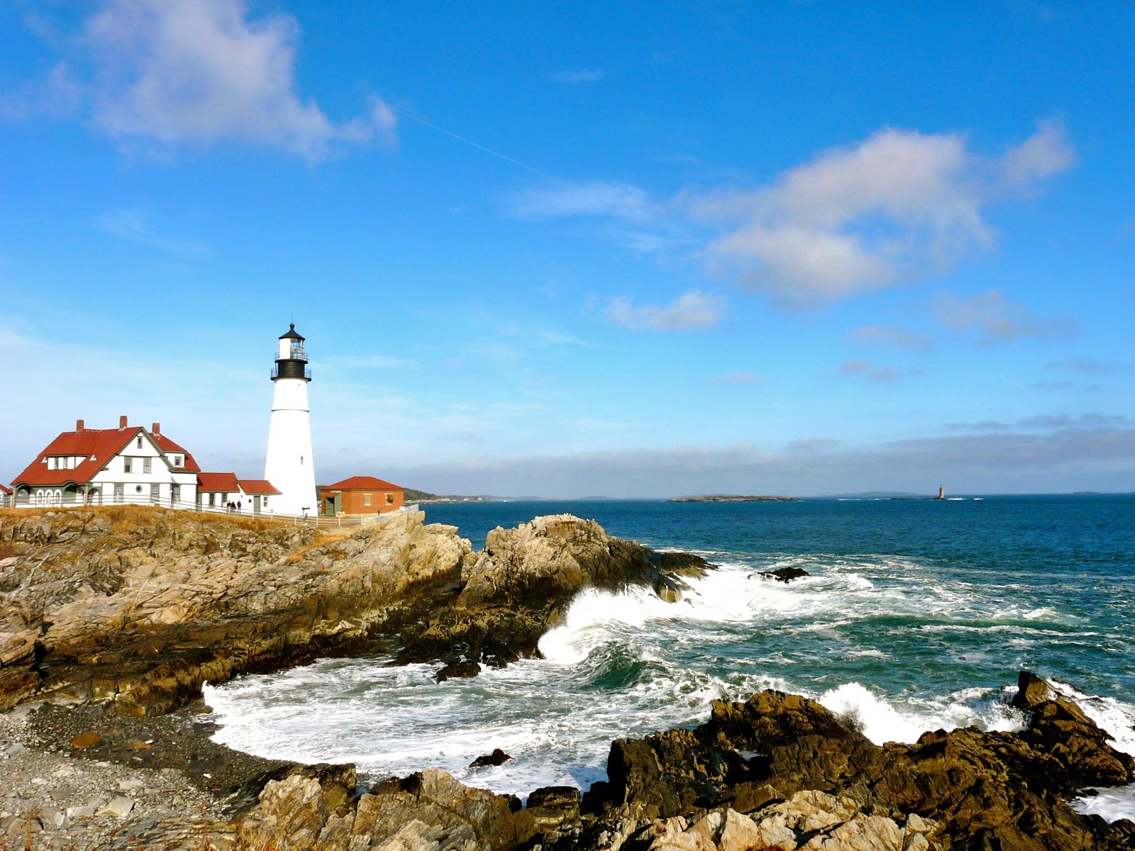
Indian Beach, Tillamook Lighthouse, and a HIKE!
Tillamook Rock Lighthouse
Since high tide prevented us from walking on the beach, we decided to head to Ecola State Park for a little hike.  To get there, take 101 west and take the City Center/Ecola State Park exit.  The park has a $5 day use fee to enter.  Park in the Indian Beach parking lot.  This is a great spot for photos of the rock monoliths and crashing waves.

We took the Clatsop Loop Trail which goes from the Indian Beach parking lot to the "Hiker's Camp".  Round trip the trail is 2.5 miles and is moderate to easy terrain.  Highlights of this hike include traveling through a coastal forest which is home to some of the largest Sitka spruce trees in the region.  My favorite part of the hike is the ocean side portion of the loop which takes you along Tillamook head and provides stunning views of the Tillamook Rock Lighthouse and Pacific Ocean.

Lunch
After the hike, we rested at Indian Beach parking lot where there are picnic tables overlooking the beach.  We enjoyed our packed lunch before driving back into the town of Cannon Beach.

Maple Bar
Maple Bar at Cannon Beach Bakery
One Last Treat
A trip to Cannon Beach would not be complete without a visit to the Cannon Beach Bakery where I always get a Maple Bar*.

*To my East Coast friends- a maple bar is a donut type treat, but instead of a ring, it is shaped as a 6 inch bar and covered in maple frosting.  Mmmmm!

On the Road again
We left Cannon around 2 pm, making sure to get one last look at Haystack Rock before heading back home to Portland.


Recommendations for a winter day at the Oregon Coast:
- Bring Rain gear:  Weather is different than the valley.  You never know what it's going to be like, but it frequently is going to be windy or wet in the winter months.
- Walk:  This might be a long stroll on the beach or a hike in Ecola Park, but in order to appreciate the Oregon Coast, you need to take it slow and get into nature.
- Start traditions:  My family's traditions of stopping at Camp 18 and getting a maple bar in Cannon Beach allow me to reminisce and remember the good ol' days while continuing to have memorable experiences with those I love.  Create your own.
-Enjoy:  If you are expecting a San Diego style beach with sunbathing and calm seas, think again.  Enjoy the Oregon Coast in winter for what it is... as well as what it isn't.  This is a rugged stretch of nature that pummeled by strong waves and wet winds. Enjoy the solitude you can experience and the kiss of cold salt wind on your cheek.

I can't wait to return.


Grey Skies and Grey water of the Pacific Ocean
Grey Skies and grey water of the Pacific Ocean

Friday, December 28, 2012

Columbia River Gorge Hike

Summit of Angel's Rest
Kelly at summit of Angel's Rest Hike
Adventure:  Angel's Rest Hike

Location:  Columbia River Gorge, Bridal Veil, Oregon

Difficulty:  Moderate difficulty.  Large elevation gain but graded trail with switchbacks makes it manageable for the average hiker.

Distance: 2.3 miles one way

The Experience:

For the winter holiday, I flew to the West Coast to spend time with my family.  One day, my sister, Kelly, and I decided to go on a little adventure.  We thought about skiing or snowshoeing but both involve so much gear and up to a 2 hour drive.  Instead, I suggested my favorite pastime ... hiking.


Angel's Rest Trailhead
Trailhead
We headed for the famous Columbia River Gorge area.  This is well known to hikers and nature lovers.  The wide Columbia River separates Oregon from Washington and simply driving along I-84 out of Portland for 40 minutes you get glimpses of steep cliffs, cascading waterfalls, and dense forest.
View on Angels Rest Trail
Great Views along the way


On this cold northwestern day, Kelly and I decided to try a trail about 30 minutes from Portland called "Angel's Rest".  The trail can be accessed easily from the parking lot just off I-84's exit 28.  We did a 4.6 mile there and back to the top of a bluff that overlooks the Columbia River and Washington State beyond.  The hike also has the pleasure of crossing near streams, through deep forest, and has switch backs that give many peaks at the river below.

icy trail
Icy last third of the way

Recommendations:

I highly recommend this hike to a visitor or local Oregonian.   My only recommendation is to prepare for ice as you climb to higher elevations in the winter months.  Kelly and I were able to manage without  any form of traction, but it was tricky.  MicroSpikes or Yak Traks would have been enough to keep our shoes on the icy trail.  Also, prepare for heavy winds on the summit (a common feature of the gorge).


Mountain Views
Mountain Views across the river


Monday, December 17, 2012

Weekend in Killington, Vermont

Long Trail, Vermont
First time on the Long Trail, VT
I drove the three hours from Kennebunkport to Killington, Vermont to spend some time with two of my best friends, Courtney and Michael.  I'd never been to Killington before.  My goals of the trip was to spend time with my friends and get outside.  Although at the time, we had not had much snow (Dec. 15-16), I brought my downhill skis in case we could go skiing at Killington Ski Resort.

I arrived Saturday morning around 10:30 am.  I dropped off my stuff with Courtney at the Econo Lodge in nearby Mendon on Rt 4.

Maine Junction - on Long Trail
It was a sunny, chilly day and Courtney and I decided to go for a little hike.  We noticed a few miles up the road the was a parking lot and a sign for the Appalachian Trail.  Without a map, we took the trail from the road and enjoyed an easy, graded trail for a few miles through hardwood forest.  We never reached a peak or good viewpoint and after a couple hours turned around and returned to the road.  I've heard rumor that the Long Trail portion of the AT is nice hiking but mostly "in the trees" as apposed to the White Mountain portion where you get frequent wide views.  Still, it was exciting to try a new portion of the AT and see the beautiful Vermont woods.

On Sunday, Courtney and I headed to the ski resort.  Tickets were $80 which was steep considering many of the trails were closed due to lack of snow.  The trails that were open were good, but crowded. A snow storm blew in starting around 10 am and continued through the day and night.  We were really grateful for the gondola which made it possible to have a comfortable ride to the top of the runs.  I would love to go back and experience Killington skiing when their runs are open and there is more snow.
Hiking with Courtney

I drove back through the storm on Sunday night.  What should have been a 3 and half hour drive ended up taking over five hours in the storm.  I got home, happy to be safe and sound with my kitties.

Thursday, November 29, 2012

Planning Guide for a Maine (and NH) Vacation

new england covered bridge
Covered Bridges found all over New England
I got an email from a friend of my mom's who is thinking of spending two weeks in Maine this upcoming summer.  She had a list of questions and after answering them, I thought I'd repost them for others to peruse.  Please leave comments if you have other suggestions!


1.  Where are the best hikes?
Jordan Pond, Acadia National Park

It depends on your hiking ability and how far you want to drive.  In Maine, you'll have two main choices for hiking... either Coastal hiking or Mountains. If you are really into hiking, I'd say Acadia National Park or White Mountain National Forest in Northern New Hampshire (2 hours from Portland) are the places to go.  

Here are my recommendations for specific hikes:

Southern Coastal Maine
- Marginal Way, Ogunquit - Beach/Coastal Walk in Ogunquit, Maine (Easy)

Mid-Coast, Maine
- Bald Mountain or Mt. Battie, Camden - Small Mountain near quaint town of Camden (Easy-Moderate)
- Acadia National Park - Fav hikes are Gorham Mountain (Moderate - Challenging), Bubble Rock (Moderate), Jordan Pond (Easy), Acadia Mountain (Moderate - Challenging)

Cog Railroad can take you to the top of Mt. Washington
White Mountains, NH
- Mt. Willard (Easy - Moderate) access from Highland Center, Crawford Notch - 3 hrs
- South Moat Mountain - (Moderate - Difficult) - all day hike  accessed from the Kancamangus Hwy
- Mt. Chocura - (Moderate - Difficult) - all day hike access from the Kancamangus Highway
- Mt. Pierce - (Moderate - Difficult) - all day hike access from Highland Center, Rt 302
- Mt. Washington (Very Difficult) - all day access from AMC Pinkham Notch Visitor Center
- Mt. Lafayette/Mt. Lincoln (Very Difficult) - all day


2.  Where are the most quaint charming villages?

Many of the coastal Maine towns are very quaint and charming...Here are my recommendations...

Southern Maine:
- Ogunquit, Maine - Beaches, shopping, restaurants.  It is very touristy but fun and beautiful.

Boats in Bar Harbor, Maine
Bar Harbor, Maine
- Kennebunkport, Maine - This is where I live.  It is very charming and has great beaches, shopping and dining.

- Portland, Maine - Charming small city.  Excellent night life and unique dining.  Check out Portland Head Light in nearby Cape Elizabeth.

Mid Coast Maine:
- Camden, Maine - Small and regal fishing town.  Tourist friendly.

- Boothbay Harbor, Maine - Small Fishing town.  Cute shops, and places to eat.

- Bar Harbor - town near Acadia National Park.  Artistic, shopping, and nature

3.  Where should we stay (maybe 3 different places)?
If I were you and I had 2 weeks I'd do something like this...

Kennebunkport buildings
Kennebunkport, Maine
- Southen Maine 3-4 nights (see Kennebunkport, Ogunquit, Portland)

- Small Fishing town Camden or Boothbay Harbor - 1 night

- Acadia/Bar Harbor 2-3 nights

- White Mountain National Forest - Stay in North Conway area for 3-4 nights

- Return to Portland/Boston or whereever you are flying out of.


4.  Are there any inn to inn hikes available?
- There are well established "hut to hut" hiking systems.  These don't provide private rooms but in the summer would provide a hearty dinner and breakfast and bathrooms/ shared bunkroom.  The one I'm familiar with is run by the AMC and can be found out about at www.outdoors.org.  There is also a hut system called Maine Huts and Trails but I've never used them.  You should know that the hiking is generally moderate-very difficult.

5.  Which part of the coast is the prettiest and most interesting?
- Southern Coast has sandy beaches and is more tourist friendly with a wide variety of restaurants, accommodations, and things to do.  

- Mid Coast is more rocky/rugged and a fisherman's land (less tourism).  I think one of the small towns like Camden or Boothbay Harbor would be a charming one night stop.
Boats in Kennebunkport
Boats in Kennebunkport, Maine 

- Acadia is gorgeous because it has mountains up against the ocean which provides many places for beautiful views.  Plus, Bar Harbor has a thriving scene for tourist looking for good food and shopping.  

6.  Any ferries to take us to Nova Scotia or outer islands?
- Nope.  Last year they ended ferry service to Nova Scotia.  
- If you want a short ferry trip - try the 20 min ferry from Portland to Peaks Island.  Check out my blog entry here for info on what do do on the island:  HERE.

7.  Any other tidbits you’d like to share?

lobster roll and fries
Lobster Roll 

- Bring Bug Spray

- Use a map and bring appropriate gear if hiking in the White Mountains.

- Use Trip Advisor Forums for quick questions.  There are some really knowledgeable people on there who love to answer questions.

- See the Portland Head Lighthouse in Portland, Try a Lobster Roll, Whoopie Pie, and Maine Maple Syrup, and get into nature.


Sunday, November 25, 2012

A Brisk Lighthouse Walk

Portland Head Light, Cape Elizabeth, Maine
If you want to experience gorgeous views of ocean and lighthouses, try visiting Portland Head Light at Fort Williams Park in Cape Elizabeth, ME.

This is a must see for any visitor to Southern Maine, but it also is a great place for locals to frequent.  No matter how many times I visit this spot, I'm speechless by the beauty of the crashing waves, rugged coast, and regal lighthouse.

Matt and I visited the park this weekend.  If visiting in the fall and winter, make sure to bundle up as the winds make it a cold spot.

Here's how I enjoy my time at Ft. William's Park...

Rocky Beaches
Fort William's Park and Portland Head Light

Trail: Easy, Family Friendly, Dog Friendly, Picnic

Directions: Cross the bridge (77) from Portland into South Portland.  Once there, follow signs to the Portland Head Light on Shore Road.  Map provided at portlandheadlight.com 

Parking: Once in the park, I follow the driveway in, and then take a right to the far gravel parking lot.  All parking in the park is free for visitors.  If you take a left, you can park in the smaller lot by the beach/playground.

Ram Island Ledge Light
Walk: Walk to the Portland Head Light, then take the trail North along the coastline.  Stop to enjoy views of the lighthouses.  You can also see views of Ram Island Ledge Light off the coast.  Continue down to the beach/playground area. Here you have a choice to go up to the right to see the abandoned fort or to the left where you can see the old Goddard mansion.  I enjoy walking back along the road and crossing up to the gazebo and covered picnic area.  There are some great interpretive signs here with information about the area.  The park is over 90 acres, so you can choose your own  challenge.  All trails are easy, graded, and gravel.  My little loop is probably about 1.5 miles.

Trail at Fort Williams Park


Other Activities:  The park offers great picnic facilities, many large fields for soccer or frisbee, and high winds which is excellent for kite flying.


This park is a New England treasure and a must see for anyone visiting Maine.  As a local Mainer, I never get sick of visiting this precious spot.

Feel free to comment and share what you enjoy about Ft. Williams Park

Goddard Mansion


Thursday, November 15, 2012

Kennebunk Beach Walk - Off Season Adventures


Kennebunk jetty
Kennebunk Beach Jetty

3.6 Miles of crashing waves, rocky shores, and sandy beach....

There are many wonderful beaches in Southern Maine.  For those who enjoy hiking, but don't want to drive the long distances to the Whites, try a nice long beach walk.

Middle Beach Kennebunk
Rocky Kenebunk Beach
A cool fall day or even blustery winter walk in the beaches of Southern Maine provides an intimate experience.  With few other beach goers, and rugged temperature, its easy to appreciate this pure nature experience.

I like to frequently walk to Kennebunk/Goochs Beach in Kennebunk, Maine.  Below are directions and mileage for this walk.

A Long Beach Walk
1.8 one way, 45 min one way
Terrain: Easy

- Leave from Kennebunkport's Dock Square and walking to Mother's Beach, Kennebunk.

- Park in the public parking next to Allison's restaurant in Dock Square, Kennebunkport (free in November-spring).

- Cross the bridge and walk on Western Ave toward the 4-way light (toward Kings Port Inn).

- Take a left on Beach Ave.  This part of the walk passes nice homes, the Franciscan Monastery, and the famous White Barn Inn.

- This road curves right after passing the river.  This is Goochs Beach - known for it's wide sandy beach, wide cement walkway, and summer surfing and suntanning.

Map to Kennebunk Beach
by Google Maps: A. Kennebunkport, B. Goochs, C. Middle, D. Mothers
- Continue along the shore and it will turn at "Middle Beach".  This is a rockier stretch of beach continues to Mother's Beach which is a small sandy stretch with a playground.

- I end my walk here, turn around and travel back.  All in all, this trip is 1.8 miles one way or 3.6 round trip - totaling about an hour and a half round trip.

This beach walk can be shortened by parking at Goochs Beach.  Street parking is easy to find and free in the winter months.  During peak season, parking can be hard to find and a parking pass is necessary.

I hope you enjoy the Kennebunk Beach scene and find away to get into nature without driving two hours from Southern Maine!

Gooches Beach
Beaches are empty in the off season


Wednesday, November 7, 2012

A White Mountain Snowshoe

View from Lila's Ledge, White Mountains, NH
View from Lila's Ledge in Pinkham Notch


Old Jackson Road Trail Junction
Old Jackson Road trail junction
This is the perfect half day snowshoe/winter hike in Pinkham Notch, New Hampshire!

As the first projected Noreaster hits New England, it's time to think about places to snowshoe and winter hike.  Here is a great half day snowshoe that promises great views, cardiovascular workout and moderately difficult hiking. It can be done every season of the year.

This hike leaves from Pinkham Notch Visitor Center/AMC Joe Dodge Lodge on Rt. 16 in the White Mountains of New Hampshire.  Use a map to guide your trek, but here are instructions on how I hike the loop...

1.  Leave from AMC Joe Dodge Lodge and hike up Old Jackson Rd. (AT).  This is a flairly flat section.
2.  Take a right onto the Crew Cut Trail right after the "bridge".
3.  Continue up the Crew Cut Trail to Lila's Ledge.  This ascends steeply to a nice overlook with gorgeous views.  Stop and enjoy the views of Wildcat Ski area and Tuckermans Ravine.
View of Pinkham Notch NH from Lila's Ledge
View of Pinkham Notch from Lila's Ledge
4.  Next, travel down Liebeskind's Loop trail.  This can be steep in heavy snow, but has beautiful rock views and forest.
5.  Take a left at the George's Gorge Trail and hike back until you reach the Old Jackson Road again.
6.  Take Old Jackson Road back to the AMC Jodge Lodge/Pinkham Notch visitor center.

Overall, I believe this loop to be about 4.5 miles.  In heavy snow, it will take 3-5 hours and shorter in less snow.

For this half day winter hike, remember to pack...

- Map and Compass
Snowshoe hike
Snowshoe and winter hiking in the White Mountains
- 2 Liters of water
- Snacks
- First Aid kit
- Extra warm layers including hat, gloves, scarf, fleece, and shell.
- Wear warm weather non-cotton clothing
- Wear winter boots and bring traction (Yaktrax, MicroSpikes, or Snowshoes)
- Treking poles or ski poles
- Head lamp

For a more complete list of things to pack refer to the previous post: Ten Things to Pack for a Fall Day Hike.


Jenny and I on our Pinkham Notch Snowshow
Jenny and I enjoy snowshoeing off Old Jackson Rd.

Ask the information desk at AMC Pinkham Notch Visitor Center if you have questions or concerns.

Please leave any questions of comments about this hike below!

Thursday, November 1, 2012

Cooking without electicity - My favorite backcountry meals

camp cooking
Cooking without electricity
As I prepared for Hurricane Sandy, I realized that being an avid backpacker, I had some of the tools, skills, and experience to cook comfortably without the use of power.  I packed up my MSR Whisperlite stove, fuel bottle, extra fuel, and stocked up on a bunch of backcountry friendly foods in case I lost power for a week or more.

As it was, we were very lucky in my neck of the woods and I never had to rely on my back-country cooking.  My heart goes out to those without power, water, and major losses from this storm.  For those of you looking for delicious cooked meals that don't require regular refrigeration,  here are my favorite backcountry meals...

*Note: A backpacking stove should never be used indoors nor in a tent.  You should always cook in a well-ventilated outdoor space.  


Favorite Backcountry Meals

1.  Stir Fry - This dish proves that just because you aren't in your home kitchen, it doesn't mean you can't have a healthy and well-balanced meal.

Tools
- Stove (I use a MSR Whisperlite)
- Fry pan/Wok
- Sauce pan/pot for rice
stir fry on a whisperlite stove.
Healthy Stir Fry
- Spatula, knife, cutting board

Ingredients
- Tempeh (protein that's packaged and can go days without refrigeration.  Find it near tofu/vegetarian aisle.) Cut into 1 cm cubes.
- Veggies - You can use peppers, onion, garlic, canned beans, mushrooms, carrots or broccoli (fresh or frozen), etc - Cut them up!
- A seasoning sauce (Soy, Teriyaki, Stir Fry dressing)
- Boil-in-Bag brown rice (takes less time and no measuring required)
- Oil

Instructions
Prep time: 20 min.  Cook time: 20 min.
- Marinate Tempeh with garlic and a little bit of sauce (Soy, Teriyaki, Stir Fry dressing)
- Brown Tempeh, sauce, and garlic in oil.
- Stir Fry veggies.  Add cooked Tempeh and more sauce and cook together.
- Boil water in sauce pan/pot (on second stove if you have it, otherwise do this after you make veg)
- Cook boil in bag rice as directions instruct
- Put rice in serving dish and stir fry over it.  Add more dressing if needed.
- Enjoy!


2.  Mac and Cheese Melody - This is a way to add flavor and nutrients to your typical mac n cheese dinner.

Tools
brocolli and onion
Add cooked broccoli and onion to your mac n cheese.
- Stove (I use a MSR Whisperlite)
- Fry pan
- Sauce pan
- Spatula, knife, cutting board

Ingredients
- Box of Mac n Cheese (I like either Kraft or Annies)
- Broccoli (fresh or frozen cut up),  Onion diced
- Oil
- Pepperoni Stick - cut into bite sized pieces
- Butter

Instructions
Prep time: 8 min.  Cook time: 15 min.
- In fry pan, cook up broccoli and onion in a little oil. Set aside.
- Boil water in sauce pan.  Cook Mac n cheese as directed on box.  Instead of milk, leave a little extra water in noodles and add a little extra butter (if you don't have butter, you can use oil).
- Stir in cooked broccoli, onion. 
- Stir in cut- up pepperoni.
- Enjoy!

3. Pita Pizzas - These are fun and everyone can make their own. Great for kids and teens!

Tools
- Stove (I use a MSR Whisperlite)
- Fry pan with lid
- Spatula, knife, cutting board

Ingredients
- Pitas
calzone
Calzones
- Cheese - shredded
- Can of tomato sauce
- Oil
- Toppings for pizza - pepperoni stick, veggies, olives, canned pineapple, etc

Instructions
Prep time: 5 min.  Cook time: 5-10 min per pizza.
- Place pita in warm fry pan with a little bit of oil.  Flip pita after one side cooks.
- While in pan, add sauce cheese, and toppings to upright warmed side of pita.
- Turn heat to low and cover pan.  Monitor pizza so it doesn't burn.
- Remove from heat and enjoy!
*If you fold the pita you make a calazone- type pocket and this often helps the cheese to melt easier.


I hope you enjoy these recipes and use them on your camping adventures!  Please leave comments or questions below.  


backcountry cooking
Backcountry Cooking


Sunday, October 28, 2012

Peaks Island Day Trip

double lighthouses viewed from 20 min ferry ride to peaks
Double lighthouses viewed from 20 min ferry ride to Peaks island.

I lived in Southern Maine for 5 years before I ever took the trip out to Peaks Island.  I missed out.  It is the perfect outing for those looking for a change of scenery, casual seaside stroll, or bike ride.  This is a great idea for a fall outing since the crowds have cleared and you can expect a quiet, quaint island.
Ferry comes into Peaks Terminal

Follow this recipe for a perfect afternoon on Peaks....

10:10 am - Arrive in Portland.  Park and walk to the Ferry terminal.
10:25 am - Purchase ferry ticket.
10:40 am - Board Ferry to Peaks.
10:45 am - Ferry departs Portland.
11:05 am - Arrive at Peaks. De-board.
11:15 am - Walk up road and turn right on Island Ave.  Go to  The Peaks Island House for and early lunch and drink on the deck overlooking Casco Bay. 
12:15 pm - Exit the restaurant walk the island... This is a 4 mile stroll.
  • Continue walking down Island Ave, 
  • Turn left on New Island Ave
  • Right on Whitehead St. - You'll pass the 5th Maine Regiment Museum on your right.
  • Right on Seashore Ave which will take you down to the shore.  
  • Continue walking on Seashore Ave. You'll pass views of beach, quaint island homes, and rocky shore.
  • You will continue on Seashore Ave as it winds back into the inland island.  Continue past Pleasant Ave and wind down to Island Ave.
  • Stay on Island Ave until you return to the main part of town.  
  • Return to Ferry terminal.  
    hiker strolls along Seashore Ave
    Stroll along Seashore Ave
2:30 pm - Finish walk and grab a coffee at Peaks Cafe near the ferry terminal.
2:40 pm - Board ferry back to Portland.
2:45 pm - Depart back to Portland.


Bike Option:

- Rent a bike at Brad's Island Bicycles.  Bring cash.  This is an honor system in the off season and comes with a island map.  Once off the ferry, you can get to Brad's by walking up the road and taking a left on Island Ave.  Brad's will be about a 10 min walk on the right.  Address: 115 Island Ave., Peaks Island, ME.  Phone: (207) 766-5631

More advice for Peaks...

map around peaks
Map by google maps
- Check out the ferry schedule at http://www.cascobaylines.com/.  It usually departs Portland once an hour with some exceptions.

- The ferry is very affordable.  It is currently $7.70 round trip ($4.10 off season) with $6.50 extra if you are bringing a bicycle on.   Show up to ferry a 20 minutes prior to departure to get your ticket and get to your gate.

- There is a parking garage at the ferry terminal, but passengers shouldn't expect this to have open spots during the high season of summer.  Other options are street parking or other City of Portland garages which can be found on the Casco Bay Lines website under parking (here).  

- The ferry ride to Peaks takes 20 minutes one way and you will likely see lighthouses, islands, and lobster/fisherman hauling their catch. 

- Once on the island, you'll discover that the businesses are almost all near the ferry terminal.
biking peaks island
Biking is another option


Thursday, October 25, 2012

Top 10 Things to Pack for a Fall Day Hike

fall hiking trail
Fall Hiking Trail
Fall is one of my favorite times to hike.  The temperature is often that perfect point where you aren't sweating from the heat and humidity and as you exert yourself, you warm up enough to wear a light sweater.  As the season progresses, the scenery changes as fall colors appear transitioning into trees going bear before the snow comes.  This time of year, hikers usually don't need additional traction (like snowshoes), and there are far fewer summer hikers to dodge and back up the trails.  All in all - fall hiking is the best!

Fall hiking can bring on additional challenges.  For example, shorter days mean less daylight, colder and more unpredictable weather, and the possibility of ice or snow on the trail.  It's very important to, as the Leave No Trace guidelines suggest- Plan Ahead and Be Prepared.

Before heading out for a day hike, use this list and check it twice....

hiker in ravine
Matt has all his gear in his day pack for a comfy fall hike.
1.  Non Cotton Clothing - You might have heard the term "cotton kills".  This is because wet cotton wicks heat away from your body.  Stick to these materials - nylon, poly, and wool, and don't wear jeans and a t-shirt!

2.  A Day pack - Find a sturdy backpack with a hip belt.  I use an old L.L. Bean school pack.

3. A Map - Don't try to save money or get lazy by not getting a map.  Trails can be confusing (especially in New England)  Don't leave home without one and don't rely on a phone.

4. Water - For an all day hike - at least 2 Liters, for 1-2 hour hike, one Liter should be fine.

5. A First Aid Kit - For a day hike bring sunscreen, band aids, a pocket knife, gauze/pad, tape, and benedryl/ibruprofen, space blanket, pencil, and paper.

6.  A Flashlight/Headlamp - These are life savers if you over estimate the hike length and loose daylight.

7.  Food - For a full day hike bring a meal + snack.  For a couple hours, bring a granola bar, piece of fruit, or trail mix.

8. A Rain Layer - Get a light weight waterproof jacket.  I also bring a pair of lightweight rain pants.

Fall colors in New Hampshire
9.  A Warm Layer - Bring a non-cotton warm layer like a fleece or wool sweater.  You might not need it at the start of the hike but if you stop for a snack, summit view, or first aid - you'll be glad you have it.

10.  Warm Hat and Gloves - If you are traveling up in elevation, this can really make your trip a happy one.

Optional:  I also bring the following...
* Camera - capture the memories
* Trekking Poles - protect your knees
 * Compass - it's only useful if you know how to use it
* Sunglasses - for the sunny days
* Identification (driver's license) - Just in case...
Hiker covered in leaves
Enjoy the fall


With this list, you'll be able to have a comfortable and safe hike in fall!  

I welcome comments and questions below.